
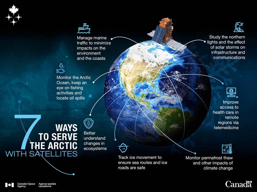
Satellites serving the Arctic and the northern communities

Canada's Arctic and northern regions cover an immense territory rich in culture, wildlife and natural resources. They play a vital role in the global climate system, and they are changing faster than almost anywhere else on Earth.
Rising temperatures are causing sea ice to shrink, glaciers to retreat and permafrost to thaw. Meanwhile, the Arctic is becoming a focus for many countries as new shipping routes open, and resources become more accessible. These changes create emerging environmental, economic, safety and security challenges for Canada and northern communities.
In this fast-changing environment, satellites help monitor these transformations and provide critical data across vast and remote areas that are difficult to observe from the ground.
The Arctic faces a number of challenges. Our satellites keep an eye on this vast territory and its biodiversity. (Credit: Canadian Space Agency [CSA])
Protecting our land
Inuit fishermen travelling on ice.
The Arctic Archipelago and the Canadian North represent over 40% of Canada's land, and more than 70% of its coastline. This vast region is home to more than 100,000 northerners in more than 100 communities, and unique wildlife. Its underground is bursting with valuable minerals such as diamonds, gold, platinum, iron and uranium. Many scientists believe that nearly a third of the world's gas and petroleum resources are hidden there. As climate change rapidly transforms the Arctic, protecting Canada's sovereignty, preserving nature, and keeping people and infrastructure safe is crucial.
Canadian satellites, like the RADARSAT Constellation Mission (RCM), allow scientists, governments, and Indigenous communities to:
- monitor land and water
- manage marine traffic
- ensure activities follow Canadian laws
- detect illegal operations even in the most remote areas
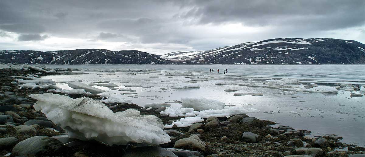
Ensuring safety in changing ice conditions
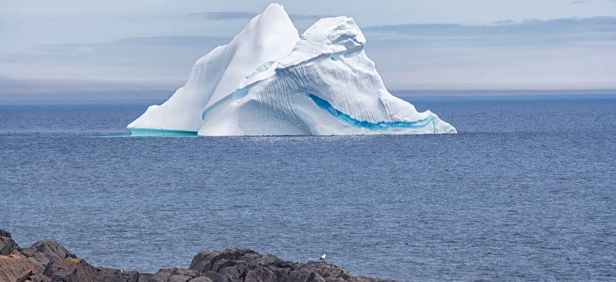
An iceberg off the Canadian coast. (Credit: Shane McKay, National Research Council Canada)
Arctic sea ice and icebergs are among the elements most affected by rising temperatures driven by global warming. Their rapid melting is reshaping the Arctic environment, altering traditional travel routes and opening new waterways for navigation in the Arctic Ocean. The retreat of ice in the Northwest Passage, in particular, offers an alternative shipping route, reducing the trip from Europe to Asia by about 8,000 km.
To respond to these changes, local authorities rely on satellites, like the RCM, to:
- track sea ice and iceberg movement
- keep sea routes and ice roads safe
- enhance security in Arctic waters
- protect northern infrastructure
- support emergency response operations
Traditional knowledge is also essential to understand changes in the Arctic. Through the smartEarth initiative, projects developed with Northern and Indigenous involvement, like SIKU, combine traditional knowledge and satellite data to support decision-making and safety.
Preserving biodiversity

A polar bear stands protectively on a vast expanse of Arctic ice, accompanied by her two cubs.
The Arctic hosts a remarkable yet fragile biodiversity, including national wildlife areas and migratory bird sanctuaries. Its waters abound with marine mammals, fish, mollusks, and crustaceans, while its ice-covered peaks and floes act as crucial regulators for the global climate.
As temperature rises, melting ice and thawing permafrost threaten northern landscapes, while wildlife habitats are rapidly shifting. These changes place increasing pressure on the Arctic's unique ecosystems already under stress.
To respond, local authorities rely on satellites, like the RCM to:
- track wildlife populations and habitat conditions
- monitor environmental change in near real time
- map terrain, sea ice, and coastal erosion
- measure ocean temperature, and monitor currents and marine ecosystems
- support Indigenous-led monitoring and traditional knowledge
- guide sustainable resource development
Providing health care in isolated regions
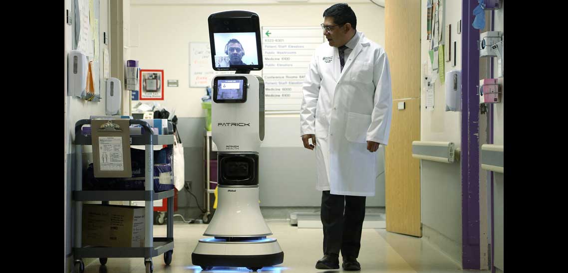
A healthcare professional uses a telemedicine robot to provide remote medical consultations. (Credit: University of Saskatchewan robotic telemedicine program)
In northern communities, access to medical care can be challenging. Long distances, harsh weather and limited local services often lead to long waits or the need to travel far from home. But space technology is opening new ways to deliver health care.
Using Canadian telecommunications satellites like Anik F2, health professionals can connect with patients from a distance to provide consultations, monitoring and support. This type of remote care, called telemedicine, is especially valuable for people living in isolated regions.
Interestingly, these communities face health care challenges similar to those experienced by astronauts on deep-space missions. Northern Canada is therefore an ideal location to test remote health care technologies.
Monitoring geomagnetic storms
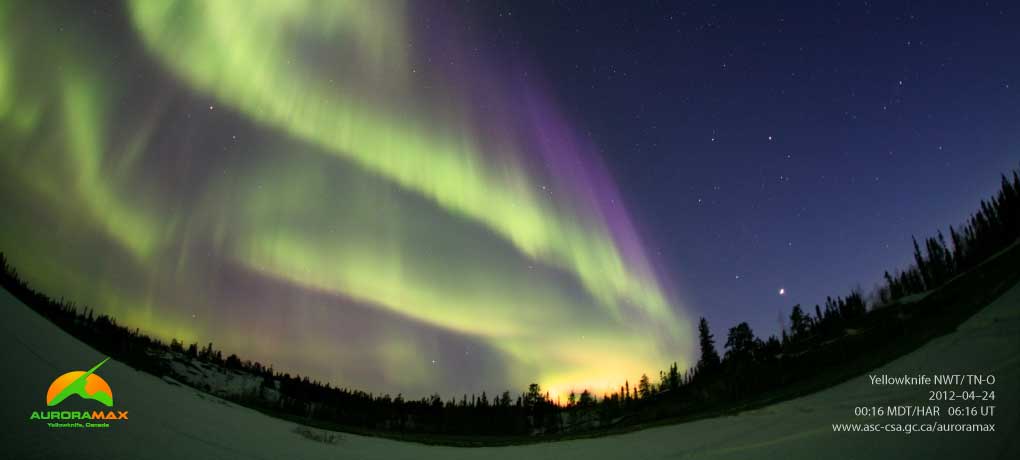
Northern lights above Yellowknife, NWT. (Credits: AuroraMAX, CSA, University of Calgary, Astronomy North)
The northern lights are a stunning display caused by solar storms. While mesmerizing to watch, these space weather events can directly affect our daily lives, disrupting telecommunications and damaging infrastructure.
Canada's northern location makes it particularly vulnerable to space weather, but it also offers a unique vantage point to observe near-Earth space, or geospace, where most space weather phenomena occur. The Geospace Observatory (GO) Canada initiative collects data from scientific instruments across the North to improve our understanding of space weather.
By studying solar activity, scientists can better predict these events and help us prepare for their effects. Research also provides deeper insights into Earth's magnetic field and magnetosphere, which protect us from the Sun's harmful rays.
Canadian satellites and instruments to serve the Arctic
Several satellites help or are expected to help monitor the Arctic, support northern communities, and study climate change:
- RADARSAT Constellation Mission (RCM): supports maritime security by detecting illegal vessels, tracks ice movement to ensure safe sea routes and ice roads, and monitors permafrost thaw along with other Arctic climate change impacts
- RADARSAT-2: predecessor to the RCM, still used for high-resolution radar imagery of Arctic regions
- SCISAT: supports climate research by monitoring the atmosphere, including ozone and pollutants
- WildFireSat (in development): expected to track active wildfires and help ensure the safety of remote communities.
- HAWC (High-altitude Aerosols, Water vapour and Clouds) (in development): expected to monitor polar atmospheric conditions in order to better understand their effects on weather and climate across Canada
Canada also contributes to international missions that support Arctic monitoring, such as SWOT (Surface Water and Ocean Topography) led by NASA and France's space agency (CNES). This mission surveys lakes, rivers, reservoirs, and oceans, providing data on water levels and ice conditions that help guide safe marine navigation.