
Geospace Observatory (GO) Canada: Monitoring and predicting space weather

Artist illustration of events on the Sun changing the conditions in near-Earth space. (Credit: NASA)
Geospace Observatory (GO) Canada is a Canadian Space Agency (CSA) program that supports a nationwide network of scientific instruments. These instruments collect data on the near-Earth space environment, known as geospace, helping researchers better understand its dynamics and improve space weather forecasting. More accurate forecasts help protect the technologies and critical infrastructure, in space and on Earth, that Canadians rely on every day.
Why space weather matters
Space weather refers to changes in the space environment caused by activity on the Sun, such as solar flares, coronal mass ejections, and changes in the solar wind.
These events can affect:
- satellites
- GPS and navigation systems
- radio communications
- power grids
- pipelines
- aviation
- astronauts and spacecraft
Notable space weather events
Space weather has affected critical infrastructure in Canada and around the world. Major events include:
- 1972: A powerful geomagnetic storm likely triggered the detonation of multiple U.S. naval sea mines during the Vietnam War.
- 1989: A geomagnetic storm caused a major power outage across Quebec, leaving millions without electricity.
- 1994: Space weather disrupted Canada's Anik E1 and Anik E2 communications satellites, affecting telecommunications services and television signals.
- 2022: A geomagnetic storm contributed to the loss of up to 40 Starlink satellites shortly after launch. The storm caused increased drag in the upper atmosphere, making it impossible for the satellites to reach their intended orbit.
Canada experiences more space weather activity than many other countries due to its proximity to the North Pole. This unique geographic location also makes Canada an ideal place to observe geospace and advance research that improves forecasting and helps reduce the impacts of these events.
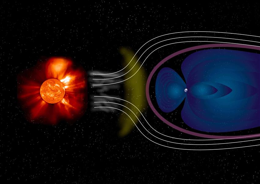
Artist impression of the solar wind – particles from the Sun – interacting with Earth's blue funnel-shaped magnetosphere. (Credit: ESA)
GO Canada program
The GO Canada program supports Canadian universities in operating scientific instruments that continuously monitor space weather over Canada.
Following the 2022 Announcement of Opportunity, the CSA awarded $6.5 million over six years to support two national projects.
SuperDARN Canada National Research Facility
The Super Dual Auroral Radar Network (SuperDARN) is a global network of high-frequency radars located throughout the northern and southern hemispheres, that monitors the movement of charged particles in Earth's ionosphere and magnetosphere.
Led by the University of Saskatchewan, the Canadian network operates five radar sites located in:
- Saskatoon, Saskatchewan
- Prince George, British Columbia
- Rankin Inlet, Nunavut
- Inuvik, Northwest Territories
- Clyde River, Nunavut
Each SuperDARN Canada radar scans more than five million square kilometres every minute, 24 hours a day, 365 days a year.
SuperDARN adheres to an open data policy, with data from all radars worldwide available to the public. Canadian data can be accessed through the University of Saskatchewan.
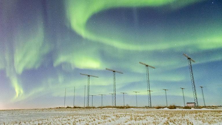
The northern lights seen over the Saskatoon SuperDARN radar site. (Credit: Ashton Reimer)
Space Environment Canada
Space Environment Canada (SEC) is a ground-based geospace observation network across the country that brings together the expertise of the University of Alberta and the University of Calgary. It integrates several projects previously supported through the Geospace Observatory (GO) Canada program, including CARISMA (University of Alberta), TREx-ASI (University of Calgary), and REGO (University of Calgary).
The network includes more than 100 scientific instruments installed at around 45 sites across the country, including 12 core sites operated by the CSA. Together, these instruments continuously monitor the near-Earth space environment and provide researchers with critical data to improve our understanding of geospace dynamics and enhance the accuracy of space weather forecasts.
SEC's instrument network includes:
- magnetometers, which measure the strength and intensity of magnetic fields
- all-sky imagers, specialized cameras that capture the entire sky to observe auroral activity
- riometers, which measure the strength of naturally occurring radio signals from space to study the ionosphere
- spectrographs, which separate light into its individual colours and record their intensities to analyze the composition and properties of the upper atmosphere

Map of Canada showing the 12 GO Canada core sites currently operated by the CSA. (Credit: RADARSAT Constellation Mission image © Government of Canada [2024]. RADARSAT is an official mark of the Canadian Space Agency. Mosaic created by the Canada Centre for Mapping and Earth Observation of Natural Resources Canada.)
SEC is one of the world's most advanced ground-based facilities for remotely sensing the ionosphere and studying space environment phenomena. Its observations support research into geospace processes and help improve our understanding of how solar activity affects Earth. SEC data is freely available online for researchers, educators and the public.

Different instruments and members of the Space Environment Canada collaboration. (Credit: SEC)