
7 ways satellites serve the Arctic – Infographic
Description
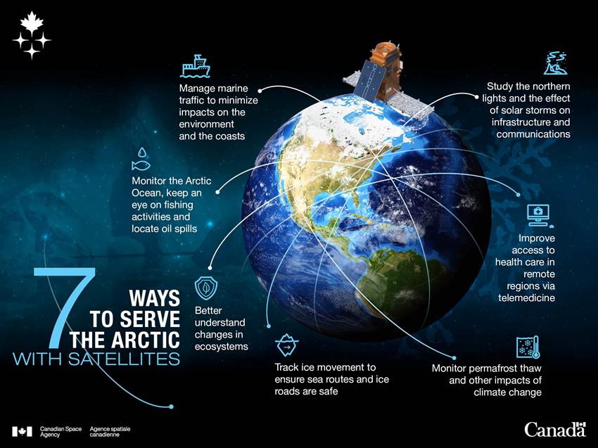
The Arctic faces a number of challenges. Our satellites keep an eye on this vast territory and its rich biodiversity. This visual illustrates seven of the many ways space serves the Arctic and the Great Canadian North. (Credit: Canadian Space Agency)
Text version
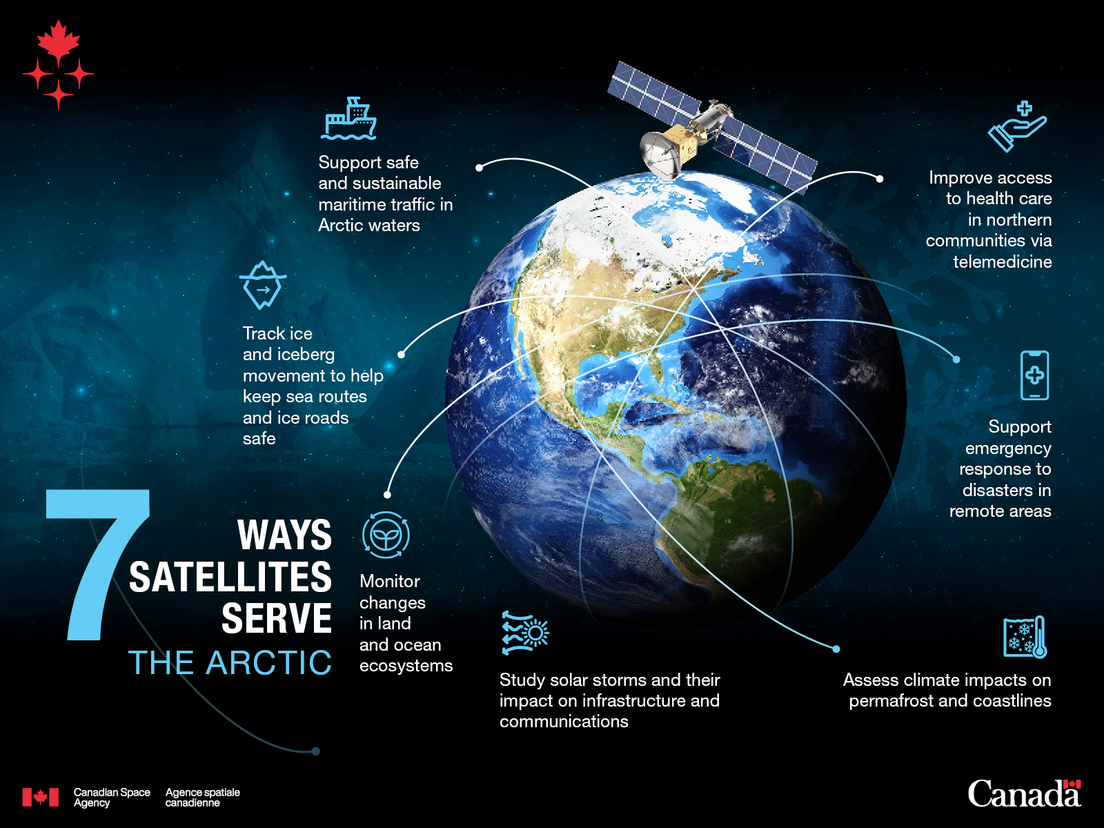
- Track ice and iceberg movement to help keep sea routes and ice roads safe
- Support safe and sustainable maritime traffic in Arctic waters
- Improve access to health care in northern communities via telemedicine
- Support emergency response to disasters in remote areas
- Assess climate impacts on permafrost and coastlines
- Study solar storms and their impact on infrastructure and communications
- Monitor changes in land and ocean ecosystems
File size: 1.05 MB
Image size: 1600 x 1200 pixels
Resolution: 96 dpi
Image date: December 19, 2025
Copyright / Permission to reproduce
- Date modified: