
Prince Albert National Park
This mosaic highlights the current and historical significance of water within Prince Albert National Park.
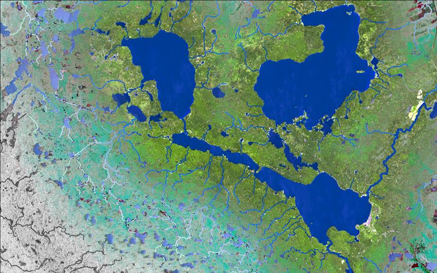
Combinations of satellite imagery were used to highlight the significance of the waterbodies, large and small. The colours are increasingly bold and vibrant with proximity to the lakes at the heart of the image, embodying the vibrancy created by the lakes themselves. This dependence and draw towards the water were likely as true for the First Nations inhabitants as they are for today's locals and tourists who enjoy the beauty and activity the lakes have to offer.
Credit: TRE Altamira. Contains modified Copernicus Sentinel-1 and 2 data processed by ESA
About the visual art
- Location: Prince Albert National Park of Canada, Saskatchewan
- Company: TRE Altamira Inc.
Traditionally, the Kingsmere, Waskesiu and Spruce rivers, emphasized within the image, were "lines of connection" for early inhabitants of the area. The smaller streams are topographic flow lines, which represent smaller but equally important flow towards the lakes, symbolizing arteries through which the lakes, and subsequently the region, are kept alive.
The greyscale colours at the outer edges of the image derive from Sentinel-1 synthetic aperture radar (SAR) imagery, acquired in the spring of . The intermediate turquoise colours are a combination of optical and SAR imagery, used to highlight the landforms, while the vibrant central colours close to the lakes derive from a Sentinel-2 optical image, acquired on Canada Day .