
Canada's Strategy for Satellite Earth Observation
Annex – Further satellite EO in action examples
Satellite EO in action:
Testing New Technology for Monitoring Greenhouse Gases from Space
Canadian industry leads the world in Fourier Transform Spectrometer (FTS) technology and is currently advancing it to better observe atmospheric gases from space. FTS enables satellite imaging of critical gases such as carbon dioxide (CO2) and methane (CH4) that are leading causes of climate change. The technology also supports the surveillance of other important greenhouse gas emissions from sources such as permafrost thaw and forest fires in a warming climate. Canada is targeting application of this new technology as part of future missions, particularly to monitor the Arctic more closely. In preparation, the GC, along with industry and academia, are working together to test prototypes using high-altitude balloons. These high-altitude balloon experiments allow scientists to test how the instrument operates in the cold, low-pressure environment of the stratosphere, a precursor to the instrument one day operating in space.

High-altitude balloon prior to launch. (Credit: ECCC-CSA)
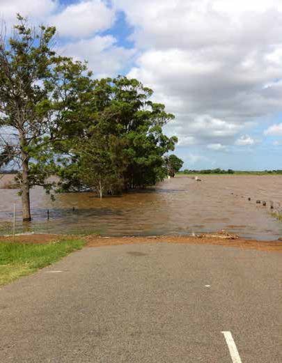
Satellite EO in action:
Satellite Earth Observations for Lake Water Quality Monitoring
The growth of harmful algal blooms in Canadian lakes has wide-ranging impacts on ecosystem health, drinking water, fisheries, and leisure and recreational activities. Early detection and comprehensive monitoring of algae is fundamental to their management and avoidance. Satellite EO has provided the means to observe blooms with unprecedented frequency and spatial coverage. The GC's EOLakeWatch delivers online satellite-derived products for algal bloom monitoring on select Canadian lakes. For local water management officials and communities, these products go a long way toward addressing existing monitoring gaps, delivering consistent data, identifying areas of specific concern, determining trends, and understanding the causes of algal blooms.

The GC's EOLakeWatch dashboard documenting near-real-time observations of algal blooms on Lake Winnipeg. (Credit: Environment and Climate Change Canada)
Satellite EO in action:
Tracking Dangerous Wildfires
Wildfires threaten the safety and well-being of those in their paths, and take a substantial financial toll on the economy each year. Approximately $1 billion is spent annually to combat wildfires in Canada, but the indirect costs – such as losses stemming from damaged infrastructure, evacuations, health impacts, and interruptions to tourism – are significant as well. Most Canadians can recall the 2016 Fort McMurray wildfire as an example of this type of costly devastation; this particular disaster had a total cost of approximately $9 billion. Canadian wildfire managers rely on information from space to be able to track and monitor wildfires, for emergency planning and to adapt to the impacts of climate change on forests. However, current space assets do not provide information during the afternoon and early evening, which is the most critical period of wildfire activity. The GC is currently exploring solutions to develop sensors that will be able to focus specifically on wildfires and their unique characteristics to address this coverage gap.

Satellite-observed forest fires in Canada's Prairies. (Credit: NASA)
Satellite EO in action:
Emergency Response at Home and Abroad
Whether helping to track cyclones in Bangladesh or monitoring fires in Western Canada, satellites help in the face of catastrophe year after year, all over the world via the International Charter "Space and Major Disasters." The Charter was created to provide valuable near-real-time data quickly, and at no charge, to users who need it to respond to major disasters. The agreement represents international collaboration among 17 Charter members operating more than 60 satellites, and has responded to events in 126 countries to date. When the Charter is activated, countries such as Canada prioritize satellite "tasking" to image the affected area as soon as possible so that local officials can quickly provide the requested data to front-line responders. The Charter has been activated nearly 700 times.
Satellite EO in action:
Identifying Vulnerability and Monitoring Disease Risk
According to the World Health Organization, 75% of emerging infectious diseases are of animal origin. Of particular concern to Canada is the distribution and quantity of vectors such as ticks and mosquitoes and the diseases they can carry (Lyme disease, West Nile virus). Habitat availability for ticks and mosquitoes is expected to increase with climate change, resulting in northward spread of diseases already present in North America as well as the invasion of exotic vector-borne diseases from subtropical regions. Satellite EO data can provide an early signal on the risk of these infectious diseases by enabling the GC to produce maps that show microclimate and habitat conditions suitable for vectors (e.g. ticks and mosquitoes). When satellite EO data is combined with socio-economic information, the resulting "vulnerability maps" help determine where Canadians are at risk now and in the near future: the fundamental starting point for public health risk management. Throughout the 2020–2021 global pandemic, vulnerability maps were also used to understand the potential for spread of COVID-19, showing satellite EO's valuable role in successful interventions in major public health crises.

Satellite-derived map created by the Government of Canada showing risk for Lyme disease in Eastern Canada. (Credit: Public Health Agency of Canada)