
Canada's Strategy for Satellite Earth Observation
Canada's vision for satellite Earth observation
Through long-term investments in state-of-the-art satellite EO technologies, collaborative partnerships, and skills development, we envision a Canada that is:
- Resourceful in using domestic and international satellite data across all economic sectors to increase productivity, drive efficiencies, and ignite innovation.
- Resilient in adapting to our changing climate, from the international to the local scale, with the best science-based evidence for effective decision making.
- Ready to respond to environmental, national security, public safety, and health challenges, with timely information, modern infrastructure, and a next-generation workforce.
Whole-of-society engagement
As we carry out this strategy, the GC is committed to continuing a unified approach for planning and stakeholder interaction through webinars, engagement opportunities, and requests for feedback. Our vision recognizes the need to continue strengthening whole-of-society collaboration through a policy of free, open, and accessible data that will enable industry, academia, governments, and Indigenous communities across Canada to benefit from satellite EO. It also acknowledges the vibrant worldwide satellite EO community and the role of international collaboration in meeting our own needs while contributing to global issues such as climate change. Canada will continue to participate in global initiatives for open data and science, development of data standards, and collaborative missions through international partners and multilateral fora, such as the World Meteorological Organization and the Group on Earth Observations. Ultimately, we envision a lively ecosystem of satellite EO stakeholders interacting to provide services to Canadians, enable scientific breakthroughs, and foster economic activity.
Satellite EO in action:
Supporting Food Security Across Canada
Understanding trends in agricultural production is essential to addressing short- and long-term threats to food security in Canada while maintaining a profitable, competitive, and sustainable agricultural sector, a major driver in Canada's economy. The GC's Canadian Crop Yield Forecaster (CCYF) uses a mix of satellite and climate information to forecast crop yields both during and after the growing season. Information generated by the CCYF is critical to agricultural monitoring, as it affects both economic forecasting and risks to agricultural production, such as those from weather and climate (e.g. drought, flash floods, untimely rains, frost, hail, and storms). At the individual farm level, Canadian companies use satellite EO and advanced analytics to generate online services for customers to pinpoint and better manage unproductive or problematic areas of farmland. Increased use of satellite EO-based technologies within the agricultural sector could produce cost savings to Canadian farmers up to an estimated $1.3 billion over the next decade.

End-to-end integration and innovation
Satellite EO in action:
Enabling Accurate and Rapid Weather Forecasts
Accurate weather forecasting is vital to helping us go about our daily lives. It also helps in planning business activities and saving lives through early warnings. To enable these benefits, the GC receives millions of observational data points every day from satellites orbiting Earth. This data is processed through complex computer models to provide daily weather information to Canadians. Satellite imagery not only enables an accurate weather forecast, but also allows forecasters to assess aviation hazards, such as low clouds, thunderstorms, hurricanes, and the evolution of dust plumes. More than 90% of the data that goes into weather models is from space, making satellites critical to delivering accurate and timely weather information. However, weather forecasts are not just about planning our days and getting around safely. A study by the World Meteorological Organization found that free and open national weather services in countries like Canada create at least four times their cost in societal and economic benefits.
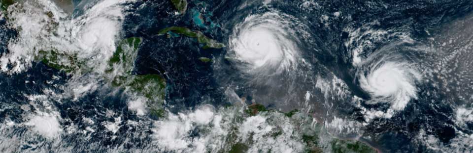
Satellite image of Hurricanes Irma, Jose, and Katia in the Atlantic Ocean in . (Credit: National Oceanic and Atmospheric Administration (NOAA)/Reuters)