
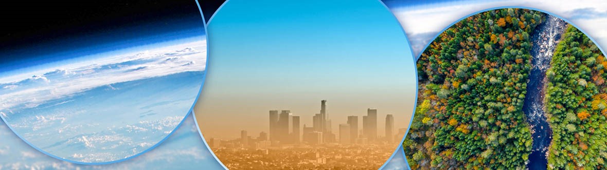
Studying Earth's atmosphere and surface using satellite data
The Canadian Space Agency (CSA) is supporting 21 research teams from across Canada to advance scientific knowledge and understanding of Earth's atmosphere, vegetation and water. In analyzing data from instruments aboard Canadian and international satellites, sometimes combined with ground-based observations, they will investigate important issues like air quality and greenhouse gas emissions, ozone recovery, increased drought and wildfires in boreal forests, and the state of Canada's lake and rivers.
CSA grants and contributions
The projects were funded under the CSA Class Grant and Contribution Program following the Announcement of opportunity: Earth System Science Data Analyses. To learn more about current CSA opportunities, visit the Opportunities page.
The research grants awarded by the CSA for these projects represent a total value of approximately $5 million over three years to advance atmospheric and climate science using data collected by Canadian satellites and instruments like CloudSat, MOPITT, OSIRIS, RCM, SCISAT, SMAP, SMOS and SWOT. These Canadian datasets are complemented in many cases with new European Space Agency (ESA) satellites that gather measurements of Earth's surface and atmosphere.
What will researchers do with the satellite data?
Earth system science project summaries
Air pollution
Assessing biomass burning and short-lived climate forcers in Canadian atmospheric models with Canada's satellite and ground-based assets
Future environmental policy requires improved atmospheric models supported by experimental data. This project will use Canadian space datasets from SCISAT and MOPITT on Terra to further advance climate and air quality models from Environment and Climate Change Canada to understand the distribution of air pollutants from wildfires and greenhouse gases. This could improve air quality forecasts based on pollution emissions.
Research team
- Dr. Kaley A. Walker, University of Toronto (principal investigator)
- Dr. Diane Pendlebury, Environment and Climate Change Canada (ECCC)
- Dr. David Plummer, ECCC
- Dr. Kimberly Strong, University of Toronto
- Dr. Cynthia Whaley, ECCC
Arctic interactions
Aerosols, clouds and aerosol-cloud interaction (ACI) over the Arctic: analysis using aerosol and ACI modelling in support of ground- and satellite-based measurements
Understanding the influence of tiny, suspended particles (aerosols) on the climate is especially important over the Arctic, where impacts of climate change are particularly strong. This project will study the interaction between aerosols and clouds over the Arctic. It will combine models with data from the CloudSat satellite, ground-based measurements from a suite of instruments at the Polar Environment Atmospheric Research Laboratory (PEARL) in Eureka, Nunavut, and other measurements. This research could help scientists better understand aerosols and their seasonal to yearly trends, which affect climate models.
Research team
- Dr. Norm O'Neill, Université de Sherbrooke (principal investigator)
- Dr. Jean-Pierre Blanchet, UQAM
- Dr. Rachel Chang, Dalhousie University
- Dr. Patrick Hayes, Université de Montréal
- Dr. Maud Leriche, UQAM
Emissions
Assessing forest fire and wetland emissions in Canada using satellite remote sensing
Strategies to reduce pollution emissions target both carbon monoxide, which affects air quality, and methane, a potent greenhouse gas. This project will study carbon monoxide emissions from forest fires and methane emissions from human activities by using Canada's MOPITT measurements and an ECCC air quality model. The results could help reduce uncertainty on these pollutant emissions and improve numerical models.
Research team
- Dr. Debra Wunch, University of Toronto (principal investigator)
- Dr. Dylan Jones, University of Toronto
Upper troposphere and lower stratosphere
The atmospheric temperature, humidity and clouds in the upper troposphere and lower stratosphere (UTLS)
About 12 km to 17 km above Earth's surface lies the upper troposphere – lower stratosphere. This project will study this region to understand the distributions of clouds, water vapour and temperature and how they change simultaneously. Researchers will integrate data from Canada's SCISAT satellite and NASA's CloudSat into ECCC's numerical weather prediction system, and compare the results to other space-based and aircraft datasets. This is expected to improve Canada's weather and climate modelling abilities, and help develop future satellite missions.
Research team
- Dr. Yi Huang, McGill University (principal investigator)
- Dr. Man Kong (Peter) Yau, McGill University
- Dr. Mark Buehner, ECCC
- Dr. Zhipeng Qu, ECCC
- Dr. Paul Vaillancourt, ECCC
Mineral dust
Mineral dust aerosols in Northern Canada: Sources and impacts on climate and air quality
This project will study suspended dust particles in the atmosphere above northern Canada and their emission sources. Space-based measurements, including the Canadian OSIRIS instrument and the CPR instrument on the CloudSat satellite, combined with models from the ECCC, will help advance this work. A better understanding of the impact of these dust particles is expected to help quantify the warming or cooling of the atmosphere, cloud formation and their characteristics, and air quality.
Research team
- Dr. Aldona Wiacek, Saint Mary's University (principal investigator)
- Dr. Patrick Hayes, Université de Montréal
- Dr. James King, Université de Montréal
- Dr. Adam Bourassa, University of Saskatchewan
- Dr. Knut von Salzen, ECCC
Aerosols
Observational and theoretical constraints on stratospheric aerosol radiative forcing
The cooling or warming in the stratosphere, which sits 10 km to 50 km above Earth, is a key component of climate change. This project studies the influence of small-sized suspended particles (aerosols) on this phenomenon. Aerosol characteristics collected through space-based measurements from Canadian instruments OSIRIS (on the Odin satellite) and MAESTRO (on the SCISAT satellite) will be used in two Canadian models. The results could improve our understanding of past variations in climate, and can also help develop models using aerosol properties to predict future climate change.
Research team
- Dr. Matthew Toohey, University of Saskatchewan (principal investigator)
- Dr. Adam Bourassa, University of Saskatchewan
- Dr. Jason Cole, ECCC
- Dr. Christopher Sioris, ECCC
- Dr. Knut von Salzen, ECCC
Pollutant emissions
Quantifying trends in top-down emission estimates of CO and NOx
Improved estimates of pollutant emissions are critical to assessing the effectiveness of pollution regulations. This project will focus on better evaluating emissions of carbon monoxide (CO) globally and nitrogen oxides (NOx) in North America. Researchers will combine models with observations from multiple space-based sensors, such as Canadian instruments MOPITT on Terra, ACE-FTS on SCISAT and OSIRIS on Odin. This research could help determine what contributes to uncertainty in emission estimates.
Research team
- Dr. Dylan Jones, University of Toronto (principal investigator)
- Dr. Adam Bourassa, University of Saskatchewan
- Dr. Daven Henze, University of Colorado Boulder
- Dr. Chris McLinden, ECCC
- Dr. Kazuyuki Miyazaki, Jet Propulsion Laboratory
Extreme events
Space-based observations for predicting weather and climate extremes in Canada's North
Rapidly warming temperatures in the Arctic are increasing the occurrence of extreme events like snowstorms, melting polar ice, and wildfires. They profoundly impact people and ecosystems in northern Canada. Researchers will combine data from multiple satellites, including CloudSat, to further advance ECCC's current weather forecast systems and Earth System Model. This could improve our understanding and forecasting of extreme events and their impacts on nearby land regions through snow cover and wildfire.
Research team
- Dr. Christopher Fletcher, University of Waterloo (principal investigator)
- Dr. Paul Kushner, University of Toronto
- Dr. Stephen Howell, ECCC
- Dr. Zen Mariani, ECCC
- Dr. Stéphane Laroche, ECCC
Ozone
Understanding lower stratospheric ozone trends from satellite data and model simulations
This research will study the state and trends of the stratospheric ozone layer, which lies between 15 km and 35 km above Earth's surface. It will combine observations from Canada's OSIRIS and ACE-FTS instruments with simulations from an ECCC atmospheric model. This is expected to help predict ozone recovery in the stratosphere.
Research team
- Dr. Susann Tegtmeier, University of Saskatchewan (principal investigator)
- Dr. Doug A. Degenstein, University of Saskatchewan
- Dr. Kaley A. Walker, University of Toronto
- Dr. David Plummer, ECCC
- Dr. James Anstey, ECCC
Crop cycle
Analysis and modelling of microwave remote sensing data for soil moisture and crop cycle monitoring
This project will study characteristics of Earth's surface such as soil moisture, vegetation dry matter content (biomass), vegetation water content, and surface roughness. Researchers will use several microwave satellites such as SMOS, SMAP, and Canada's RCM. The results will enhance our understanding of the connection between Earth's surface and the atmosphere, and help improve crop monitoring and water resource management.
Research team
- Dr. Ramata Magagi, Université de Sherbrooke (principal investigator)
- Dr. Kalifa Goïta, Université de Sherbrooke
- Dr. Aaron Berg, University of Guelph
Water balance
SWOT's contribution to improving knowledge of the water balance and connectivity of Canadian lakes
This research project aims to improve knowledge of the water balance, i.e. the sum of water inflows and outflows, and of connectivity of Canadian lakes using satellite data from SWOT and the RCM. It also aims to assess the added value of that information for numerical modelling. Among other things, this project will help improve knowledge of water levels and flooded areas around Canadian lakes.
Research team
- Dr. Mélanie Trudel, Université de Sherbrooke (principal investigator)
- Dr. Pascale Biron, Concordia University
Ocean currents
Assimilation of Simulated and Real SWOT Observations in the Northwest Atlantic
Accurate forecasts of the Northwest Atlantic currents are crucial for a range of applications such as emergency response, search and rescue, and transportation. This project will combine SWOT and other satellite measurements of sea surface height with an ECCC forecast model. This is expected to improve forecasts and help capture small-scale ocean variability in numerical models.
Research team
- Dr. William Perrie, Dalhousie University (principal investigator)
- Dr. Gregory Smith, ECCC
- Dr. Guoqiang Liu, Dalhousie University
- Dr. Biao Zhang, Fisheries and Oceans Canada at Bedford Institute of Oceanography
Flood inundation
Dynamic flood inundation modelling in regional Earth system models guided by space-based observations and machine learning
Scientists will develop a new method for modelling flood inundation in an ECCC model by combining space-based data from the SMAP and SMOS satellites with artificial intelligence. The results are expected to help understand inundation characteristics and their impacts on the local climate and region, and to develop strategies to reduce and adapt to climate change.
Research team
- Dr. Laxmi Sushama, McGill University (principal investigator)
- Dr. Lijun Sun, McGill University
- Dr. Stéphane Bélair, ECCC
- Dr. Muhammad Naveed Khaliq, National Research Council Canada
Carbon cycle
Enhanced carbon dynamics and land cover change assessment using integrated satellite-derived datasets and analysis approaches
Canadian ecosystems such as forests and wetlands are very efficient at storing carbon from the atmosphere. However, the underlying processes are not well studied for remote northern locations. This project will develop a new model for carbon exchanges using space-based data from the SMAP and SMOS satellites. This could help researchers better understand the processes of carbon and moisture exchange in these ecosystems, and the impact of their expansion northward over time due to warmer climates.
Research team
- Dr. Nicholas Coops, University of British Columbia (principal investigator)
- Dr. Michael Wulder, Natural Resources Canada's Canadian Forest Service (CFS)
- Dr. Chris Derksen, ECCC
Evapotranspiration
Improving estimates of evapotranspiration and land surface relative humidity using satellite-derived soil moisture and vegetation optical depth from SMAP-SMOS and land surface temperature from Sentinel-3
As water evaporates from the soil and other surfaces such as plants, it moves from Earth's surface to its atmosphere. This project will add to a model of this process, called evapotranspiration, using space-based measurements from SMAP and SMOS satellites. This will help develop a global drought index that combines soil moisture and atmospheric humidity measurements, which will aid in water management and fire risk identification.
Research team
- Dr. Mark Johnson, University of British Columbia (principal investigator)
- Dr. Nicholas Coops, University of British Columbia
- Dr. Monica Garcia, Technical University of Denmark
- Dr. T. Andrew Black, University of British Columbia
- Dr. Yeonuk Kim, University of British Columbia
Arctic lakes
Integrating SWOT Altimetry and Physics Based Modelling to Monitor, Understand, and Predict Changes to Arctic-Boreal Lakes
The northern part of Canada is largely covered by lakes, which are sensitive to climate change but are poorly studied. This project will develop a lake model by comparing measurements from the SWOT satellite with those from a new ground-monitoring program in the western Canadian Arctic. This could improve our understanding of the current and future state of Arctic lakes.
Research team
- Dr. Philip Marsh, Wilfrid Laurier University (principal investigator)
- Dr. Aaron Berg, University of Guelph
- Dr. Roderick Melnik, Wilfrid Laurier University
- Dr. Ben DeVries, University of Guelph
Water cycle
Multi-variate assimilation of satellite soil moisture and terrestrial water storage products in hydrologic models in support of water security in Canada
To address concerns over water access, it is necessary to monitor and predict water movement in Canada's hydrology and water resource systems. This project will use space-based data from SMAP, SMOS and other satellites to advance models describing groundwater and surface water movements. This could help us better understand the water cycle and how it varies during a changing climate.
Research team
- Dr. Xiaoyong Xu, University of Toronto (principal investigator)
- Dr. Steven Frey, University of Waterloo
- Dr. Yuhong He, University of Toronto
Water level forecasting
SWOT's value added for water forecasting in Canada
Water levels are tracked in only a fraction of Canadian lakes and reservoirs, and that affects the quality of water forecasts. Through this project, SWOT satellite data on water levels will be validated and used in ECCC's National Surface and River Prediction System, which should improve the quality of daily water forecasts.
Research team
- Dr. François Anctil, Université Laval (principal investigator)
- Dr. Vincent Fortin (ECCC)
- Dr. Étienne Gaborit (ECCC)
- Dr. Pascal Matte (ECCC)
- Dr. Mohammed Daboor (ECCC)
Boreal soil moisture
Soil Moisture Active Passive Validation Experiment – Boreal (SMAPVEx-BOREAL): Improving the performance of L-band Passive Microwave Retrievals of Soil Moisture in the Canadian Boreal Forest
Current satellites that can detect soil moisture are reliable for low vegetation areas, but are less so in forested regions. This project will compare soil moisture estimates from the SMAP and SMOS satellite missions to those from ground-based and aircraft instruments in Canada's boreal forest. The improved soil moisture estimates will improve weather, drought and forest fire prediction.
Research team
- Dr. Aaron Berg, University of Guelph (principal investigator)
- Dr. Warren Helgason, University of Saskatchewan
- Dr. Ramata Magagi, Université de Sherbrooke
- Dr. Alexandre Roy, Université du Québec à Trois-Rivières
- Dr. Stéphane Bélair (ECCC)
Wildfires
Understanding the response function of L-band passive microwave to peatland conditions – application to drought and wildfire occurrence prediction
Precipitation, evaporation and temperature in Canada's boreal forest vary due to our changing climate. This in turn influences the occurrence of droughts and wildfires. Scientists will use satellite measurements of soil moisture from the SMAP and SMOS satellites to identify areas at risk of droughts and wildfires. This could improve our understanding of the carbon cycle, predict the locations of wildfires caused by droughts in the boreal forest, and provide better estimates to air quality forecasts.
Research team
- Dr. Koreen Millard, Carleton University (principal investigator)
- Dr. Marc-André Parisien, CFS
- Dr. Amir Behnamian, ECCC
- Dr. Daniel Thompson, CFS
Droughts
Using satellite L-band observations to incorporate plant hydraulic functioning into a terrestrial ecosystem model to project future boreal forest response to drought conditions and heat stress
Leaf water status is central to understanding how drought conditions and heat stress impact vegetation. This project will use data from the SMOS and SMAP satellites to describe the water absorption and loss by vegetation in an ECCC model. This research could improve the model's ability to capture the impact of extreme events due to drought and heat. It could also help develop climate change adaptation strategies, including forest management.
Research team
- Dr. Oliver Sonnentag, Université de Montréal (principal investigator)
- Dr. Jennifer Baltzer, Wilfrid Laurier University
- Dr. Aaron Berg, University of Guelph
- Dr. Joe Melton, ECCC
- Dr. Alexandre Roy, Université du Québec à Trois-Rivières