
Keeping our ecosystems healthy
Monitoring our ever-changing ecosystems is a crucial first step to keeping them healthy for years to come. Images produced with data from Earth observation satellites like Canada's RADARSAT satellites, including the RADARSAT Constellation Mission (RCM), allow us to do just that.
What is an ecosystem?
An ecosystem consists of all of the living things, including animals and plants, in a specific area, interacting both with each other and with the elements of their non-living environment, such as soil and climate.
Solutions to farming challenges

The RCM can accurately detect crop characteristics over thousands of square metres, regardless of weather conditions.
One of the main challenges facing the agricultural community today is producing a sufficient quantity of healthy food without further damaging the environment. By monitoring moisture levels in the top few centimetres of soil, the RCM helps farmers assess soil and crop properties, enabling them to make better decisions on how to optimize crop profitability, while avoiding waste of fertilizer and water. The highly accurate data collected by the RCM enables farmers to maximize crop yields and to reduce energy consumption and the use of potential pollutants.
Helping farmers increase crop yields

Credit: Tony Balkwill
Tony Balkwill is a farmer and a farming consultant in Southern Ontario. He uses RADARSAT data to manage his crops and to help his clients do the same. RADARSAT data allows farmers to be more productive, as they can assess field conditions without having to conduct manual inspections that are really time-consuming. By monitoring moisture levels in the top few centimetres of soil, RADARSAT data helps farmers like Tony evaluate soil and crop properties. This enables them to grow more crops, while using less energy and potential pollutants. Read Tony's full story.
Sustainable forest management

Satellites help monitor the health of our forests.
Canada has 347 million hectares of forest land, accounting for 9% of the global forest cover and for 40% of the world's sustainably managed forests. Canada is a world leader in sustainable forest management – about 94% of the country's forests are publicly owned and sustainably managed. Forests and the many resources they provide are vital to the long-term well-being of Canadians. They absorb harmful greenhouse gases, are home to numerous species, supply clean water, provide jobs to nearly 210,000 Canadians, and supply us with materials for many products we use every day, including paper and wood. Managing forests sustainably is critical in order to ensure future generations will continue to enjoy these benefits. RCM data is used to detect harvesting and monitor forest regeneration, as well as to optimize forest management to preserve biodiversity and resource supply and ensure sustainable development.
Protecting wildlife habitats

Satellite data helps conserve natural habitats of wildlife species. (Credit: Ryan Hagerty)
Habitat fragmentation is a process by which wildlife habitats get divided into smaller, isolated patches. This has adverse effects on all the species that live in those fragments as well as on the overall ecosystem. Natural reasons, such as fires and change in climate, and human factors, such as urbanization and agricultural land development, can lead to habitat fragmentation. In order to preserve biodiversity, it is important to track this process. The RCM helps monitor habitat fragmentation, changes in land use in and around national parks, as well as vegetation cover and related changes. This data allows for better decision making in support of ecosystem conservation-related research, management and compliance programs.
Helping monitor Canada's changing environment
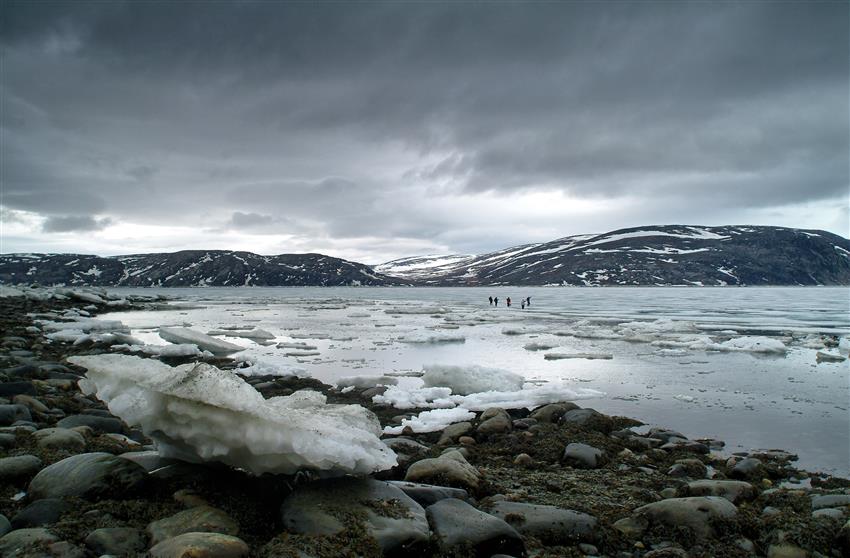
As a Resource Management Officer for Parks Canada, Brian Koonoo travels extensively to the northern tundra to compile information about the changing environment. Remaining abreast of weather conditions is a key challenge to working in this potentially hazardous region where temperatures and conditions can quickly change. Koonoo uses RADARSAT data to help identify the dangerous parts of the tundra and permafrost areas and what the best routes might be. RADARSAT data is an increasingly important part of that process, as climate change has made traditional knowledge of the Arctic icescape less reliable. Read Brian's full story.
Helping conserve wetlands

Wetlands have been recognized as especially valuable areas and are the only ecosystem designated for conservation by an international convention.
Considered as wasteland in the past, many wetlands have been drained or filled in. Recently, however, their value has been recognized and efforts have been made to protect them. Wetlands have many benefits. They can absorb the impact of large waves or floods; filter residues and toxic elements; supply food and vital habitat for many species of wildlife, especially birds; and provide us with sources of food, energy and building materials. In order to conserve and carefully use resources available in wetlands, it is necessary to map and classify them. The RCM contributes data to the Canadian Wetland Inventory, established in by the Canadian Space Agency, Ducks Unlimited Canada, Environment and Climate Change Canada and the North American Wetlands Conservation Council.
Monitoring coastal erosion
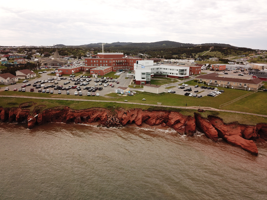
The Magdalen Islands are severely affected by coastal erosion. (Credit: Attention FragÎles)
Canada has the longest coastline in the world, measuring 243,042 km on three oceans – Atlantic, Arctic and Pacific. Home to over seven million Canadians, coastal areas boast unique biodiversity and resources. All of those are deeply affected by coastal erosion. Mapping the coasts and detecting changes in them is crucial for their development, planning, environmental protection and sustainable resource management, as well as for safe maritime navigation. RCM data is used to identify and monitor coastal erosion and to assess impacts of both climate change and human activities on coastlines, particularly the construction of wharves and sediment removal.