
The Floe of Time
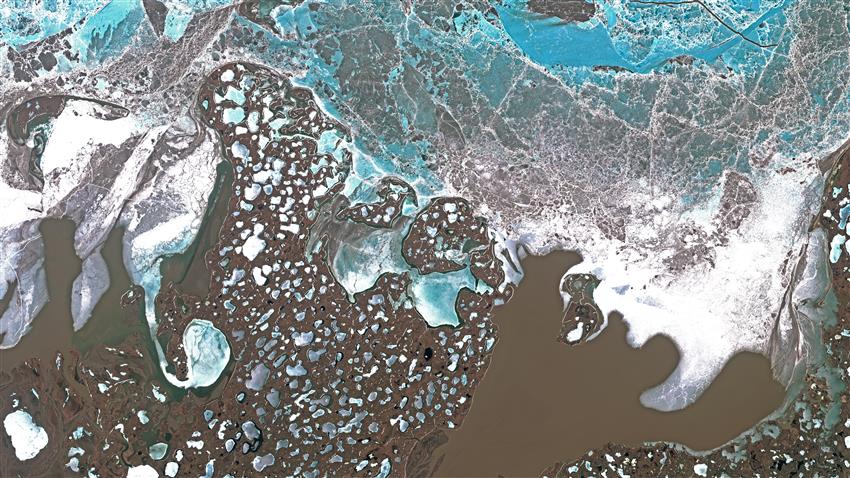
2021-06-23 - This Sentinel-2 image of June 14, 2020, covers a part of the Mackenzie River delta where the brown, sediment-rich waters of the East Arm meet the still ice-covered Arctic Ocean. The area is part of the Inuvialuit Settlement Region. Tuktoyaktuk and the Pingo Canadian Landmark lie at the bottom right of the image.
We challenged 13 organizations from across the country to create stunning satellite images that showcase the natural beauty of a region in each of Canada's territories and provinces — not a typical order for companies used to treating satellite data for scientific or commercial use. (Credit: Inuvialuit Regional Corporation, Hotspur Studio, Arctic Institute of North America, and Polar View. Contains modified Copernicus Sentinel-2 data (2020) processed by ESA)
File size: 46.06 MB
Image size: 8085 x 4548 pixels
Resolution: 72 dpi
- Date modified: