
Thick smoke blanketing the U.S. West Coast
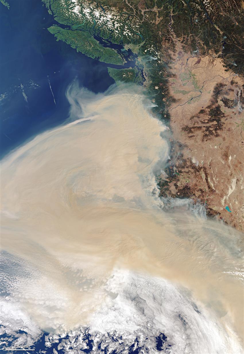
Satellite data from international space agencies aided efforts to track smoke from wildfires on the U.S.’s West Coast. Captured on September 10, this Copernicus Sentinel-3 image shows the extent of the smoke plume. (Credits: Copernicus Sentinel data (2020), processed by ESA, ESA, CC BY-SA 3.0 IGO)
File size: 6.96 MB
Image size: 4665 x 6774 pixels
Resolution: 72 dpi
Image date: September 10, 2020
Copyright / Permission to reproduce
- Date modified: