
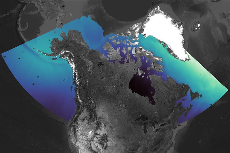
SWOT mission – Sea surface water mosaic over Canada

This satellite mosaic illustrates sea surface water over Canada. Light blue indicates higher elevations, while dark blue shows lower areas.
The SWOT satellite maps ocean surface height in 2D, scanning a 120 km-wide swath to capture fine details of the ocean's shape. By spotting eddies and currents, it reveals how heat, salt, and carbon travel – key to understanding our climate. (Credit: Canadian Space Agency, contains SWOT data processed by H2O Geomatics and ASL)
File size: 0.18 MB
Image size: 800 x 533 pixels
Resolution: 96 dpi
Image date: August 22, 2024
Useful link(s)
- Date modified: