
SWOT mission – St. Lawrence Seaway

The St. Lawrence Seaway is a network of canals and locks that connects the Great Lakes to the Atlantic Ocean.
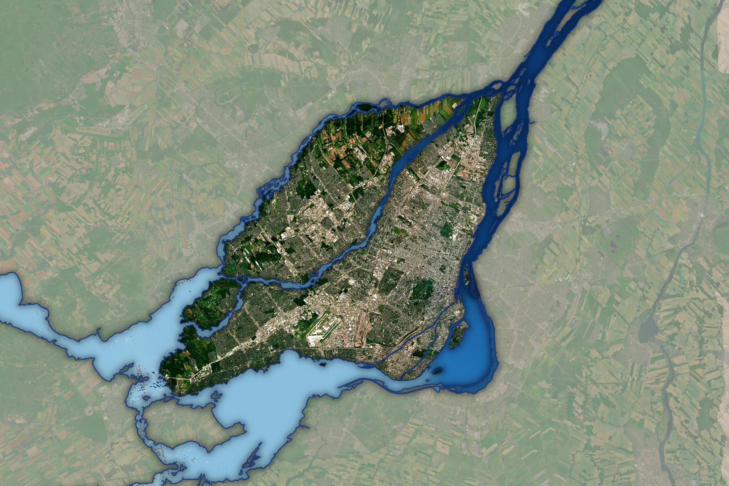
This satellite image near Montreal shows shallow waters and flow direction. Light blue indicates higher elevations, while dark blue shows lower areas.
The SWOT satellite monitors surface water elevation, improving dam regulation and navigation safety. (Credit: Canadian Space Agency, contains SWOT data processed by H2O Geomatics)
File size: 0.62 MB
Image size: 2400 x 1600 pixels
Resolution: 300 dpi
Image date: August 1, 2024
Useful link(s)
- Date modified: