
Guiding rescue efforts from space
While all eyes are on the sky for signs of stormy weather, Canadian satellite RADARSAT-2 is looking down at the Earth, both day and night. Through clouds and sunshine alike, it uses its radar system to tell us more about severe storms and the changes they make to our environment. This valuable information, along with the data obtained by the 15 other signatories of the International Charter "Space and Major Disasters," helps rescue teams on the ground make informed decisions and plan effective response efforts.
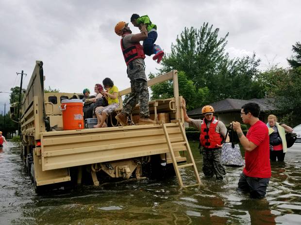
Texas National Guard members come to the aid of citizens in flooded areas of Houston following Hurricane Harvey on . (Credit: Texas Military Department, via the Environmental Protection Agency (EPA))
Identifying emergency zones from space
When Hurricane Harvey struck Houston, RADARSAT-2 imagery was used to pinpoint the flooded neighbourhoods in order to rescue affected residents as quickly as possible and assess the state of critical infrastructure (utilities and roadways).

Red indicates the flooded areas of Houston following Hurricane Harvey, as shown by RADARSAT-2. (Credit: SSL/MDA Geospatial)
RADARSAT-2 imagery also made it possible to organize emergency response efforts when Hurricane Irma slammed into the Caribbean, in order to protect the local population as best as possible.
During this unprecedented hurricane season, it is good to know that satellites are monitoring the Earth and are guiding rescue efforts towards those who need it most.

Hurricanes Irma (middle), Jose (right) and Katia (left) in the Atlantic Ocean, captured by satellite on . (Credit: National Oceanic and Atmospheric Administration (NOAA)/Reuters)