
Monitoring the impact of British Columbia wildfires from space
As emergency responders tackle the situation on the ground, satellites are collecting information to monitor the evolution and impact of the wildfires in British Columbia.
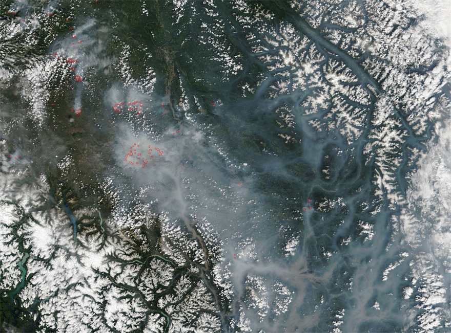
Credit: MODIS Terra satellite – NASA
On , NASA's Terra satellite captured this image of wildfire smoke filling valleys in southern British Columbia. Actively burning areas are outlined in red.
Terra is also gathering measurements of carbon monoxide levels thanks to MOPITT – a specialized Canadian sensor aboard the satellite. Smoke from forest fires increases carbon monoxide levels in the atmosphere. In high concentrations, carbon monoxide is toxic.
MOPITT data on carbon monoxide is integrated to near-real-time analysis and forecasts of reactive gases produced by the Copernicus Atmosphere Monitoring Service (CAMS).

This map shows global surface carbon monoxide concentration levels for . Areas in green, yellow, orange and red indicate increasingly high concentrations, from approximately 100 to 1000 ppbv (Part per billion in volume). (Credit: C-IFS Forecasts – CAMS)