
RADARSAT-2: Canada's eye in the sky

Description
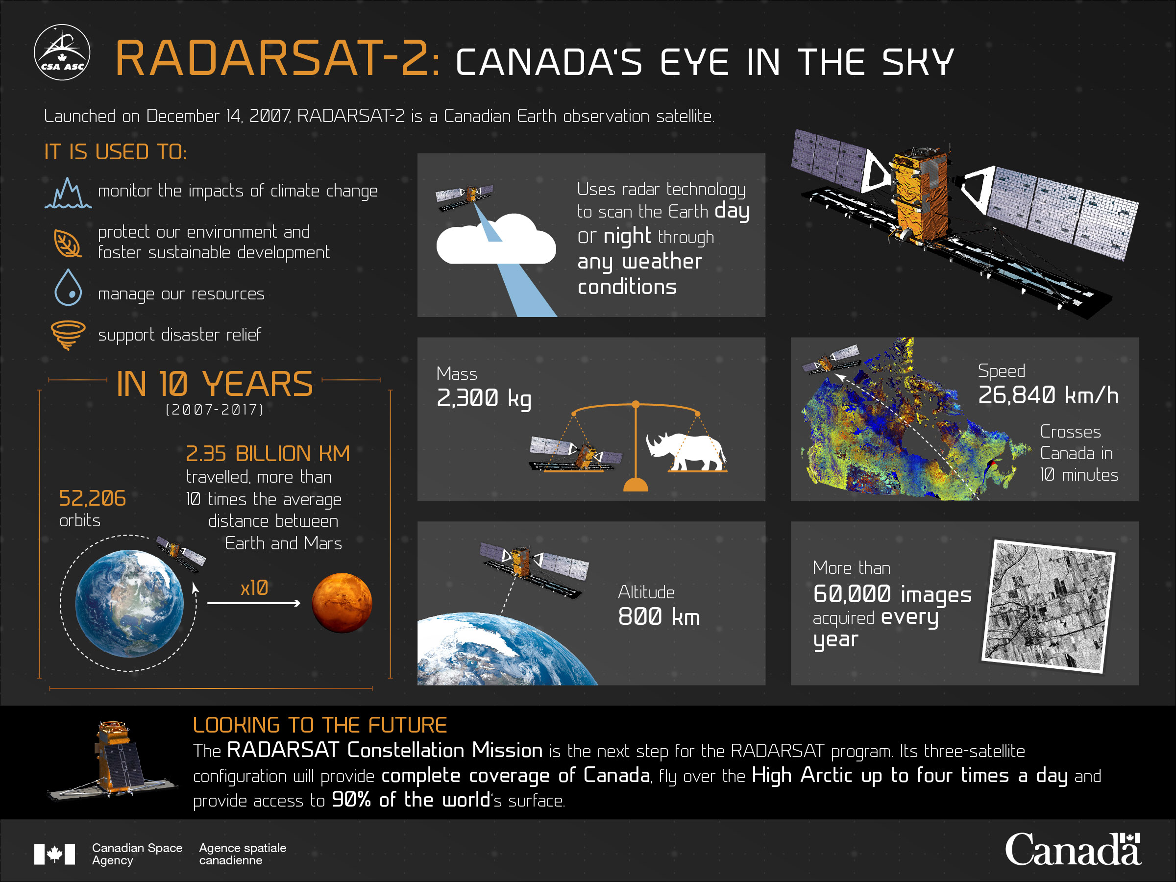
Launched in December 2007, Canada's RADARSAT-2 is an Earth observation satellite that enhances marine surveillance, ice and environmental monitoring, disaster and resource management and mapping in Canada and around the world. (Credit: Canadian Space Agency)
Text version
Launched on December 14, 2007, RADARSAT-2 is a Canadian Earth observation satellite.
It is used to:
- monitor the impacts of climate change
- protect our environment and foster sustainable development
- manage our resources
- support disaster relief
Description
- Altitude 800 km
- Uses radar technology to scan the Earth day or night through any weather conditions
- Mass 2,300 kg
- Speed 26,840 km/h
Crosses Canada in 10 minutes
File size: 1.76 MB
Image size: 2402 x 1802 pixels
Resolution: 72 dpi
Image date: October 21, 2025
Useful link(s)
Copyright / Permission to reproduce
- Date modified: