
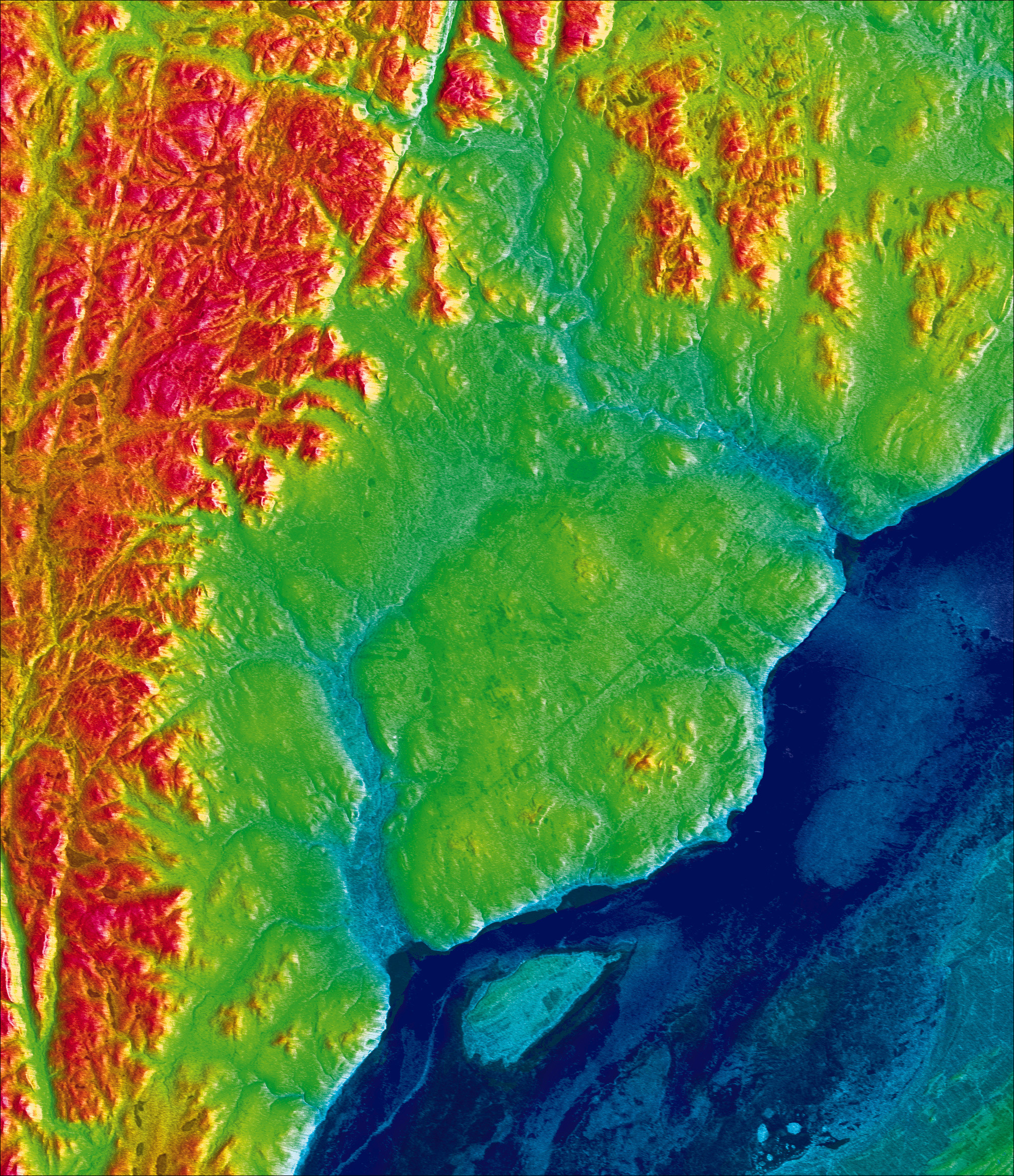
Charlevoix, Quebec, Canada March 5, 1996

The Charlevoix region is the most seismically active area in eastern Canada. The Astrobleme crater, at the centre of the image, is bounded by the Laurentian Plateau and its central peak is Mont des Éboulements. The RADARSAT image has been adjusted for terrain elevation distorsion and then integrated with a digital elevation model and bathymetric information on the St. Lawrence River. Depth is colour coded using a process known as chromostereoscopy. Colour values range from -50 metres (blue) to 1080 metres (red). The result is a 3-D display which is particularly dramatic when viewed with Chroma-DepthTM glasses. (Credit: Canadian Space Agency)
File size: 2.85 MB
Image size: 2014 x 2335 pixels
Resolution: 250 dpi
Image date: March 5, 1996
Useful link(s)
Copyright / Permission to reproduce
- Date modified: