
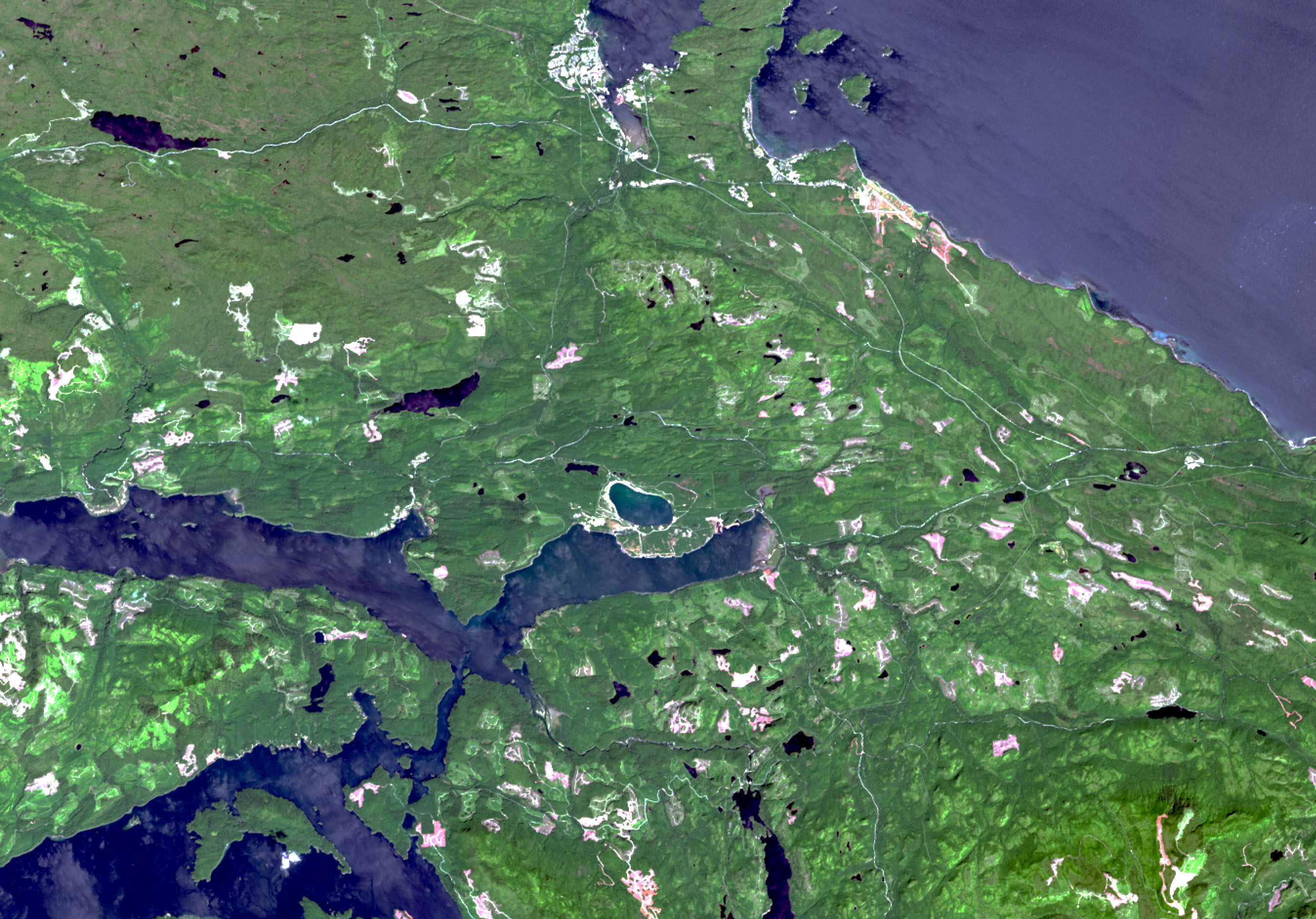
Island Copper Mine seen from space

This Landsat 8 satellite image shows Island Copper Mine in northern Vancouver Island, British Columbia.
In this true colour image, we can see the flooded mine, a small blue lake located in the middle of the image. The waters of Queen Charlotte Strait (top right) are in light blue while the waters of Quatsino Sound are in a darker shade of blue (bottom left). Vancouver Island is rich in vegetation, represented in multiple shades of green. (Credits: NASA/USGS, Landsat 8 data processed by Vertex)
File size: 0.98 MB
Image size: 2695 x 1881 pixels
Resolution: 400 dpi
Image date: July 5, 2015
Useful link(s)
- Date modified: