
The International Charter “Space and Major Disasters”: A worldwide collaboration for disaster relief – Infographic

Description
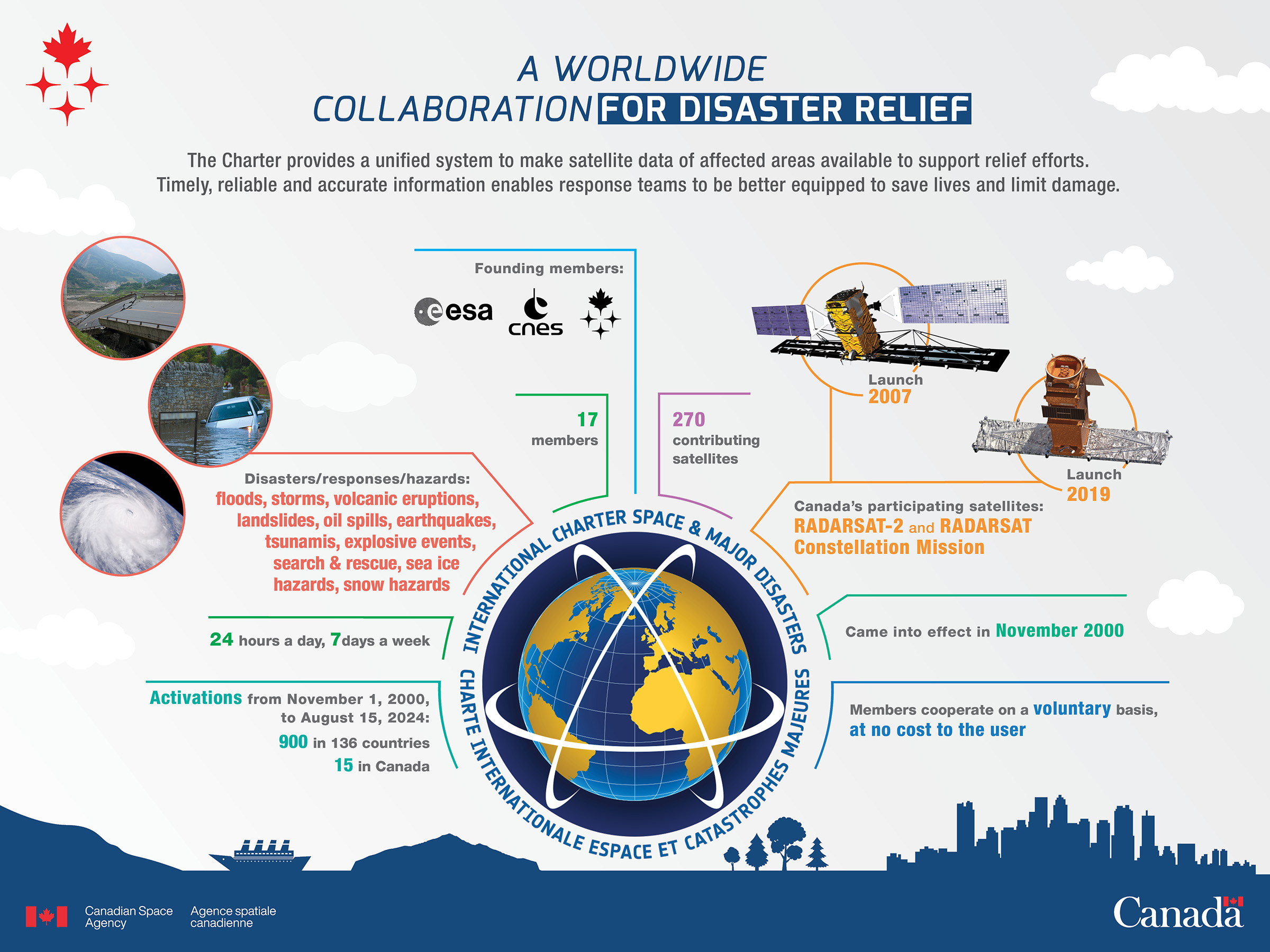
2020-10-06 - The Charter provides a unified system to make satellite data of affected areas available to support relief efforts. Timely, reliable and accurate information enables response teams to be better equipped to save lives and limit damage. (Credit: Canadian Space Agency)
Text version
A worldwide collaboration for disaster relief
The Charter provides a unified system to make satellite data of affected areas available to support relief efforts. Timely, reliable and accurate information enables response teams to be better equipped to save lives and limit damage.
- Founding members: ESA, CNES, CSA
- 270 contributing satellites
- Canada's participating satellites: RADARSAT-2 (launch: 2007) and RADARSAT Constellation Mission (launch: 2019)
- Came into effect in November 2000
- Members cooperate on a voluntary basis, at no cost to the user
- Activations from November 1, 2000, to August 15, 2024:
- 900 in 136 countries
- 15 in Canada
- 24 hours a day, 7 days a week
- Disasters/responses/hazards: floods, storms, volcanic eruptions, landslides, oil spills, earthquakes, tsunamis, explosive events, search & rescue, sea ice hazards, snow hazards
- 17 members
File size: 0.77 MB
Image size: 2400 x 1800 pixels
Resolution: 300 dpi
Image date: April 26, 2019
Copyright / Permission to reproduce
- Date modified: