
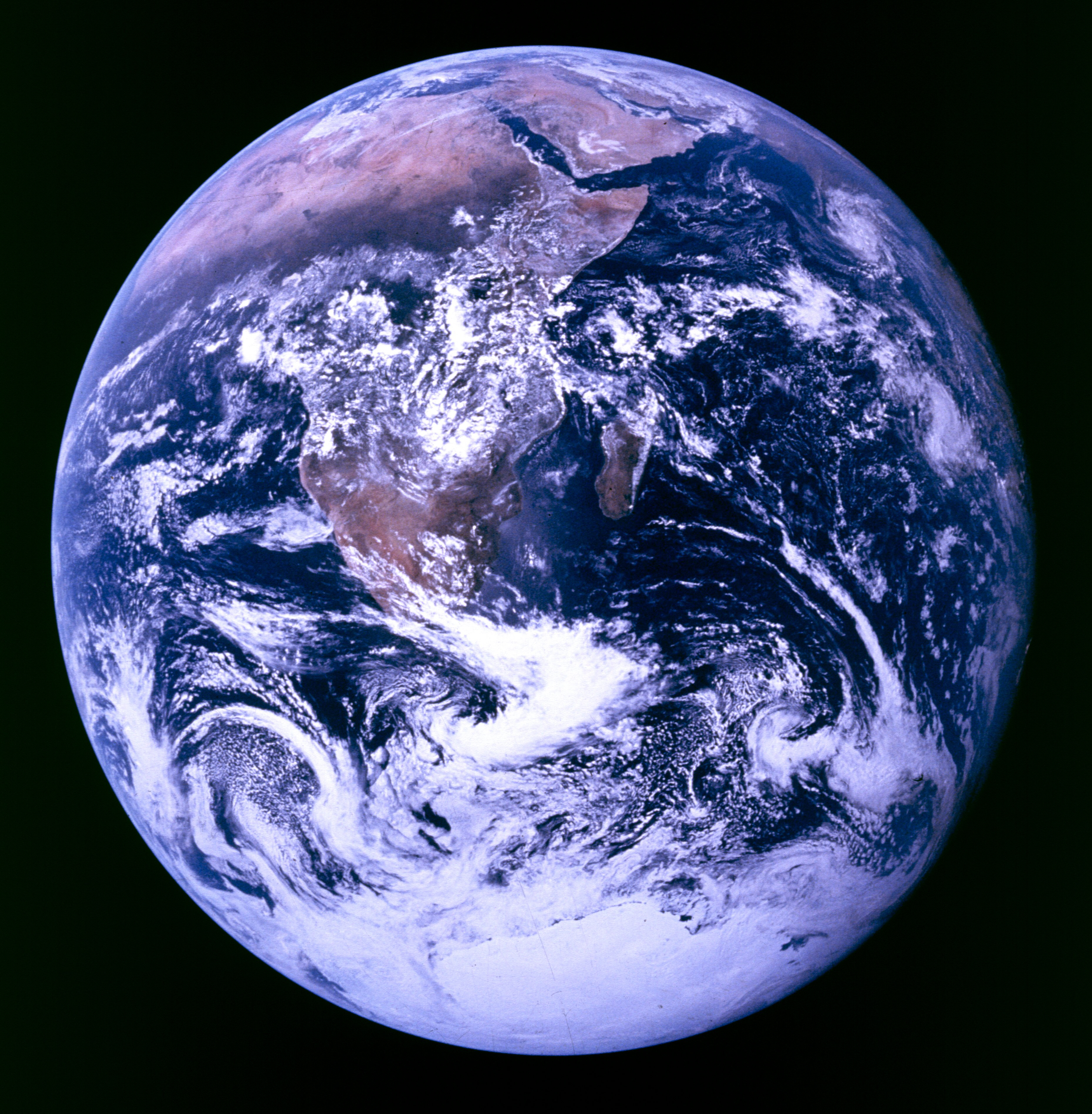
View of the Earth

This image of the Earth, taken by the Apollo 17 crew as they travelled toward the moon on Dec. 7, 1972, captures an area from the Mediterranean Sea to the ice cap at the South Pole. It was the first time the Apollo trajectory made it possible to photograph the south polar ice cap. Note the heavy cloud cover in the southern hamisphere. Almost the entire coastline of Africa is clearly visible. The Arabian Peninsula can be seen at the northeastern edge of Africa. The large island off the coast of Africa is Madagascar. The Asian mainland is on the horizon toward the northeast. (Credit: NASA)
File size: 5.51 MB
Image size: 3720 x 3796 pixels
Resolution: 3000 dpi
Photo taken on December 7, 1972
- Date modified: