
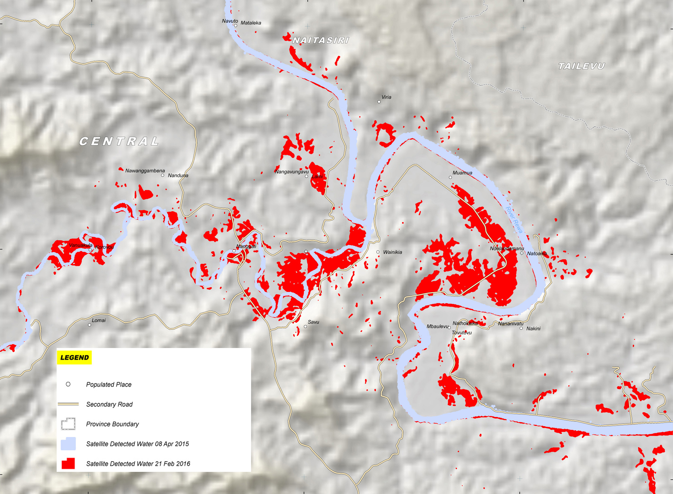
Satellite detected waters in Savu area, Naitasiri province, Central division, Fiji

2016-02-21 - This map illustrates satellite-detected waters in Savu area, Naitasiri Province situated in the south of Viti Levu Island (Fiji). Using satellite imagery collected by RADARSAT-2 on 21 February 2016 and 08 April 2015, UNOSAT identified - 1,100 hectares of land to be potentially affected by waters. The map shows the provincial boundaries (dotted line), populated places (white dot), secondary roads (yellow line) and compares satellite detected water on April 8, 2015 (blue) to satellite detected water on February 21, 2016 (red). Most of the affected areas are agricultural fields located along the banks of River Rewa.
Source: RADARSAT-2
Copyright: RADARSAT-2 Data and Products © MacDonald, Dettwiler and Associates Ltd. (2016) - All Rights Reserved. RADARSAT is an official mark of the Canadian Space Agency.
Map produced by UNITAR/UNOSAT (Credit: International Charter Space and Major Disasters)
File size: 0.86 MB
Image size: 2340 x 1719 pixels
Resolution: 96 dpi
Photo taken on February 21, 2016
Useful link(s)
- Date modified: