
RADARSAT-2 applications
The many advances in RADARSAT-2 technology were developed to respond to specific needs for radar data in hundreds of environmental monitoring applications in Canada and around the world. Through programs, conferences and funding opportunities, applications are being developed all the time. This is an overview of the main RADARSAT-2 Earth observation data applications.
Ice
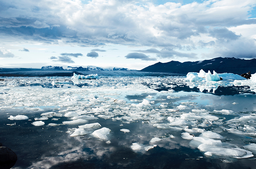
The RADARSAT program was born out the need for effective monitoring of Canada's icy waters. Earth-observation satellites have an advantage over aerial surveillance missions. Satellites operate day and night in all weather conditions. Some RADARSAT-2 capabilities that benefit sea- and river-ice applications are the multi-polarization options that improve ice-edge detection, ice-type discrimination, and ice topography and structure information.
Marine surveillance
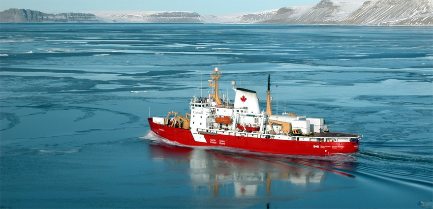
Credit: Canadian Coast Guard
Worldwide offshore resource-based operations such as fishing and oil and gas exploration and production have intensified over the past few decades. To monitor the world's oceans, Canada has provided radar data for operational applications such as ship detection, oil spill monitoring, and wind and surface-wave field estimation. RADARSAT-2 improves ship detection with its Ultra-Fine beam mode (three-metre resolution) and offers the potential for ship classification.
Disaster management
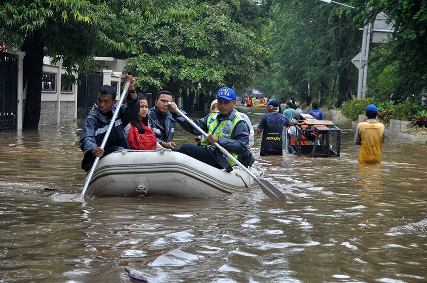
Radar satellites are key resources in a variety of disaster management scenarios. The coordination of international satellite resources for disaster response efforts is managed by the International Charter on Space and Major Disasters, of which Canada is a long-time member and data contributor.
The data has been used effectively in disaster responses such as earthquakes, tsunamis, floods, landslides, forest fires, and other natural or technological disasters. The ability to deliver data in near-real time is essential for relief operations to map and monitor damage and for assessing the impact on the future.
RADARSAT-2 reduces planning lead times for data acquisition, and its left- and right-looking modes provide more revisits and up-to-date data.
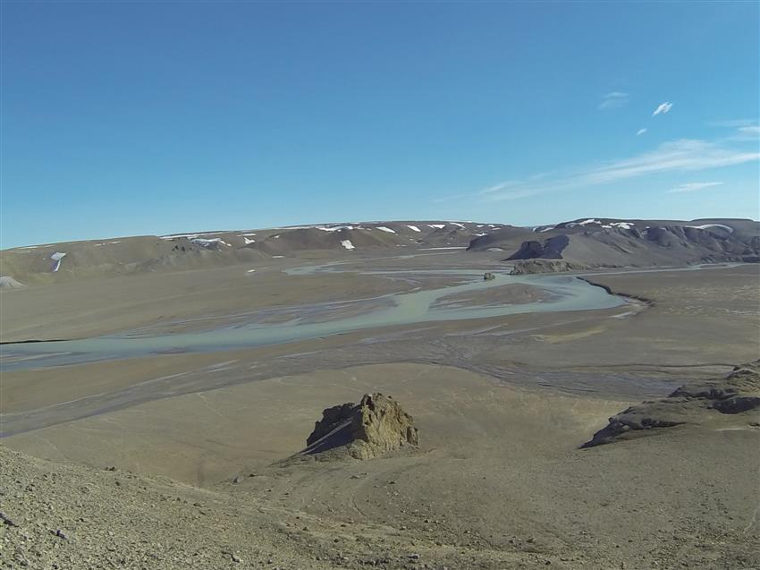
Hydrology

Credit: NASA
Radar imagery is well suited for hydrological applications, in part because the SAR, or synthetic aperture radar, is so sensitive to surface roughness and water and can thus readily distinguish between water and land features.
The polarimetric capabilities of RADARSAT-2 enhance soil moisture measurement, and snow pack monitoring and analysis, while improving the potential for SAR in wetland mapping and discrimination.
The high spatial detail provided by the Ultra-Fine beam mode (three-metre resolution) will benefit mapping applications involving coastlines, tidal and near-shore terrestrial areas, and near-shore bathymetry.
Mapping

Map prepared by the Argentinian Space Agency (CONAE). (Credit: RADARSAT-2 Data and Products © MacDonald, Dettwiler and Associates Ltd. () - All Rights Reserved. RADARSAT is an official mark of the Canadian Space Agency)
Mapping covers a broad range of activities, including the creation of Digital Elevation Models (DEMs), the detection and mapping of centimetre-scale movements at the Earth's surface (InSAR), and the extraction and identification of features to support environment management and security.
Satellite-derived data provides a synoptic view not readily obtainable from other data sources. RADARSAT-2 and its SAR can image in a variety of spatial scales. Moreover, using the variable beam modes and the left-right looking capability of the satellite, the temporal component is easily obtained, usually within time frames appropriate for the dynamic nature of the activity or specific to the region.
Geology
Credit: Canadian Space Agency
In the geology sector, Canadian radar data is used for both onshore and offshore exploration and mapping and to monitor and detect oil seeps, which reduces the risk and cost of drilling. It is also used to derive geophysical terrain information such as surface roughness, which is useful for understanding processes such as bedrock weathering and the sorting of unconsolidated solid materials.
The RADARSAT-2 advantage over other radar and optical systems for geological applications is its Ultra-fine resolution and fully polarimetric capabilities. These provide more detailed mapping of terrain features or fine geological structures, better identification of structural features and improved discrimination of geologic units.
Agriculture

Abundant harvests and crop yields depend in part on soil dynamics that fluctuate throughout the growing season. Satellite imagery is an efficient method for mapping crop characteristics over large spatial areas and tracking temporal changes in soil and crop conditions.
Built into RADARSAT-2 are several powerful features that respond directly to the needs of the agricultural sector. Dual-polarization and quad-polarization modes enable the simultaneous acquisition of multiple polarizations on transmit and receive. In the quad-polarized mode, four different polarization channels are acquired. So much valuable crop information can be extracted from one RADARSAT-2 image that there is no need for data acquisition over several dates.
Forestry
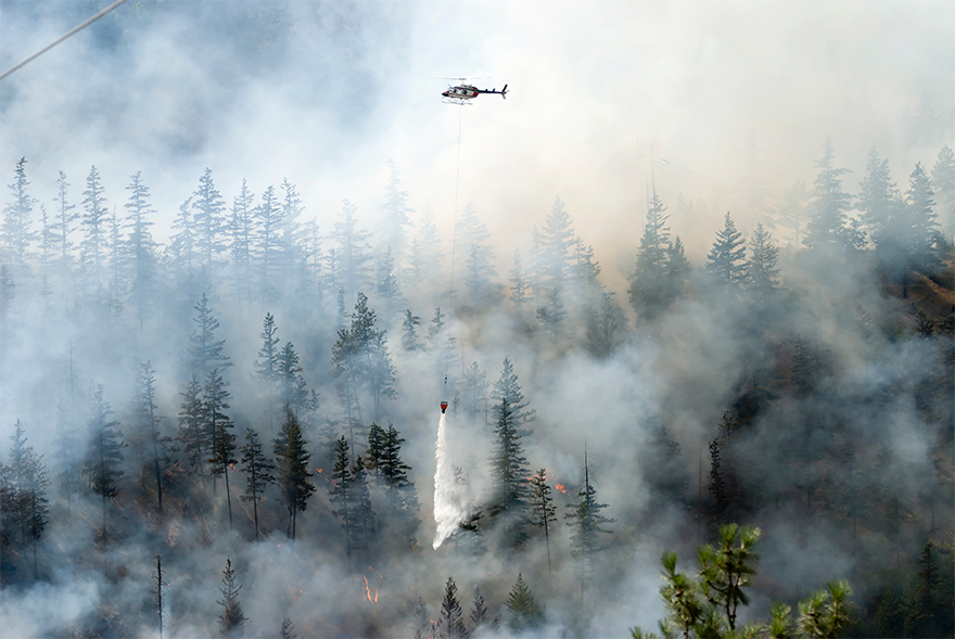
Satellite imagery is the most efficient method for synoptic coverage of forested areas and parameters.
Several applications in forestry have benefited from Canadian radar data, in particular clear-cut mapping. RADARSAT-2 offers an array of beam modes and polarimetric capabilities that could help detect structural differences in forests, and there's potential for burn mapping applications and improve forest-type mapping using textural analysis.
Explore further
- Date modified: