
SWOT – Surface Water and Topography Mission
Description
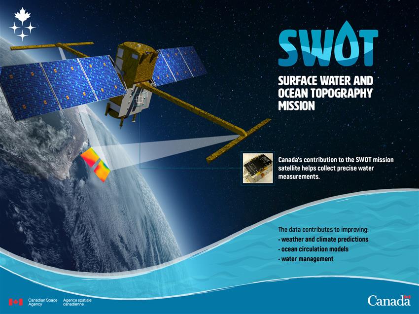
2022-11-25 – Canada is contributing a key component of NASA's radar instrument on the SWOT satellite. This device will be used to collect precise water measurements. The data collected will contribute to improving ocean circulation models, weather and climate predictions, and water management. (Credit: Canadian Space Agency)
Text version
The infographic shows the Earth from space, with the SWOT mission satellite in the foreground. There is an arrow pointing at the spot on the satellite where Canada's contribution to the mission, a high-tech-device, is installed. There is a picture of the device on the infographic.
Canada's contribution to the SWOT mission satellite helps collect precise water measurements.
The data contributes to improving:
- weather and climate predictions
- ocean circulation models
- water management
File size: 2.56 MB
Image size: 2400 x 1800 pixels
Resolution: 72 dpi
Photo taken on November 25, 2022
Useful link(s)
Copyright / Permission to reproduce
- Date modified: