
First engineering image captured by the RADARSAT Constellation Mission

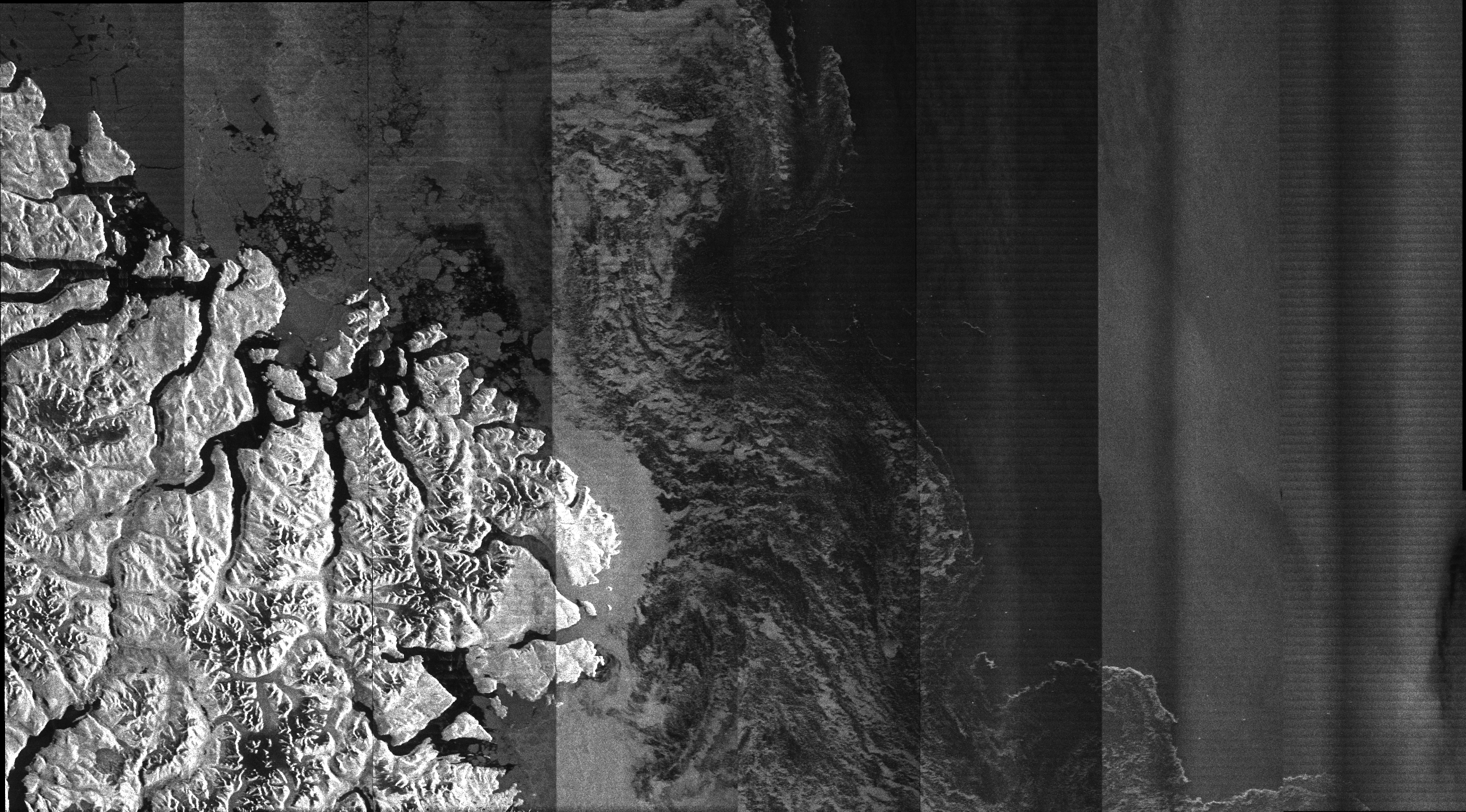
2019-06-29 - One of the RADARSAT Constellation Mission (RCM) satellites captured its very first engineering image of the sea ice in the Strait of Davis and the coast of Baffin Island, Nunavut, including the community of Qikiqtarjuaq, home to about 600 people. This non-calibrated image was acquired on June 29, 2019, at a 100-metre resolution in a low noise ScanSAR mode.
The RCM is currently in a three- to six-month commissioning phase after being launched to space on June 12, 2019. The trio of satellites will provide daily images of Canada's vast territory and maritime approaches, as well as images of the Arctic. It will have daily access to 90 per cent of the world's surface. The RCM is also equipped with an Automatic Identification System (AIS), allowing safe navigation as well as improved detection and tracking of ships, including those conducting illegal fishing.
By downloading this image, the user agrees and understands that they may release hardcopy prints of the Product, publish the Product in research reports, journals, trade papers or similar publications, and post the Product to websites provided that such Product is in a secure format that allows only printing and viewing and prohibits manipulating the Product’s pixel or metadata; all providing that such release, publishing or posting is solely for non-commercial uses and that the copyright notice is conspicuously displayed alongside the Product. (Credit: RADARSAT Constellation Mission product © Government of Canada, 2019 – All rights reserved. RADARSAT is an official trademark of the Canadian Space Agency)
File size: 4.2 MB
Image size: 2592 x 1436 pixels
Resolution: 100 dpi
Photo taken on June 29, 2019
Useful link(s)
- Date modified: