
The North Cape Eddies: A Satellite Tribute to the Traditions of Prince Edward Island

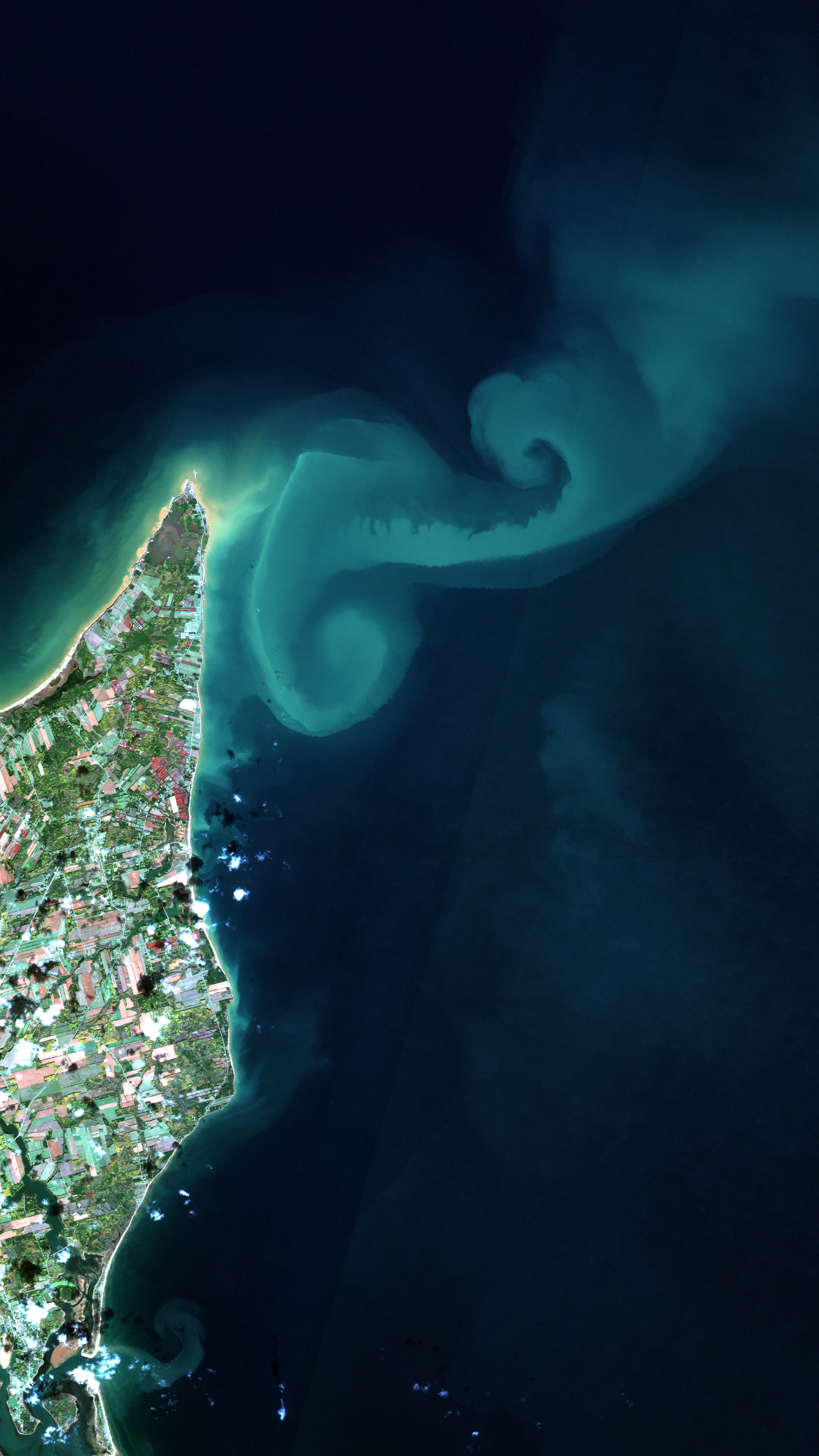
2021-06-23 - North of Prince Edward Island, the meeting of currents from the Gulf of St. Lawrence and the Atlantic Ocean creates huge eddies several kilometres long, usually invisible to the naked eye. Thomas Jaegler, geographer, enthusiast and remote-sensing specialist, brought out the natural beauty of this image acquired on October 21, 2018, by the European Space Agency's Sentinel-2 satellite.
We challenged 13 organizations from across the country to create stunning satellite images that showcase the natural beauty of a region in each of Canada's territories and provinces — not a typical order for companies used to treating satellite data for scientific or commercial use. (Credit: Thomas Jaegler, Arctus. Contains modified Copernicus Sentinel-2 data processed by ESA)
File size: 29.77 MB
Image size: 4320 x 7680 pixels
Resolution: 1200 dpi
- Date modified: