
Effective maritime surveillance
Bordering three oceans – Atlantic, Pacific and Arctic – Canada has the longest coastline in the world. In fact, Canada's ocean environment is equal to about 70 percent of the country's land mass. That makes for a lot of Canadian waters to monitor and survey!
Canada's RADARSAT satellites, including the RADARSAT Constellation Mission (RCM), are able to obtain data regardless of climate conditions or time of day. Therefore, they are particularly efficient in monitoring marine and coastal areas, which often have cloudy and foggy weather conditions.
On radar images, like the ones produced with RADARSAT-1 and RADARSAT-2, ships appear as shiny objects contrasted against a dark background of open water. The RCM makes it even easier to identify ships by combining Automatic Identification System (AIS) technology with radar imagery, and to distinguish between open water and coastal areas through changes in image contrast.
Safe passage in icy waters

RCM data helps ensure safe navigation in icy waters.
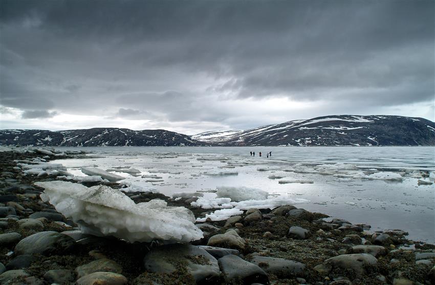
Navigating through sea ice is a real challenge for ships and their captains. A wrong move can lead to a detour from a safe route, resulting in wasted fuel or even getting stuck in the ice. RCM data helps ensure safe, efficient navigation by providing information on ice quantity, density and strength, as well as on the ice formation cycle. It supports Canada's commercial marine sector, as well as helps improve weather forecasting methods.
Navigating sea ice to deliver supplies

Credit: Michael Stokes
Michael Stokes is a ship's captain who mostly works in the Arctic. He brings food and supplies to a remote mining community. He is one of the few captains operating in the region. RADARSAT data is essential to his work. The ship he navigates is 40 years old and is the oldest in the fleet. That means he has to be extra careful to avoid getting jammed in sea ice, which risks damaging the ship. RADARSAT data provides Michael with the details that he needs to make navigation decisions to keep his crew safe and ensure the supplies are delivered. Read Michael's full story.
Making travel in the Arctic safer
Brian Koonoo is a Resource Management Officer at Parks Canada. He travels a lot in northern regions to study and compile information about the changing environment. It's a potentially risky job, as he often travels by boat, by snowmobile or on foot, in cold or hazardous environments. He uses RADARSAT data to help identify the dangerous parts of the tundra and permafrost areas and what the best routes might be. RADARSAT data is an increasingly important part of that process, as climate change has made traditional knowledge of the Arctic icescape less reliable. He also uses the data to inform other people in his community about hunting and fishing routes. Read Brian's full story.
Predicting stormy seas

RCM data helps select sites for wind farms.
The driving force behind weather at sea, the wind affects all marine operations. Stormy seas pose danger. The RCM frequently gathers precise information on surface winds. This knowledge helps improve weather forecasting and warning systems in order to effectively support marine operations. This information also helps select sites for wind farms.
Keeping our waters clean

RADARSAT data is used to detect oil pollution in Canadian waters. (Credit: National Oceanic and Atmospheric Administration (NOAA))
Oil spills pollute our waters and pose grave danger to marine life, including coral reefs, fish, dolphins, whales and birds. Quick and accurate detection of oil spills enables environmental protection organizations to effectively monitor, contain and clean up substances, and to protect sensitive coastal areas. Over the last 5 years, RADARSAT-2 has helped detect over 200 oil anomalies in Canada. The RCM continues this work by helping locate oil spills as they happen. It also allows to predict the direction they will take and their drift by using a map of marine wind directions derived from radar images.
Protecting our waters
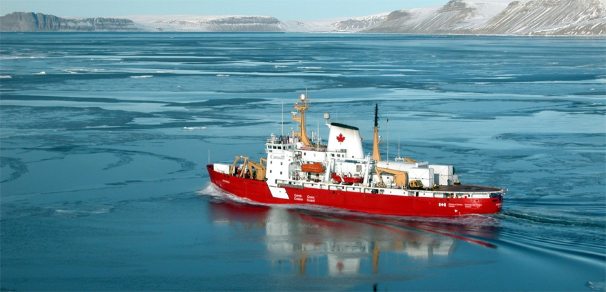
RCM data helps protect Canadian waters. (Credit: Canadian Coast Guard)
Surrounded by three oceans, Canada has a lot of territorial waters to protect. Illegal fishing is detrimental not only to marine ecosystems, but also to up to 75,000 Canadians who rely on legal fishing and fishing-related activities for their livelihood. By combining AIS technology with radar imagery, the RCM enables quick detection of ships of various sizes navigating in Canadian waters, including those conducting illegal fishing. This knowledge helps protect marine biodiversity and combat overexploitation and illegal fishing. The resulting improved awareness and understanding of the maritime situation near Canada's coasts enhances security in support of Canadian sovereignty.
Explore further
- Using satellites to protect and navigate Canada's waters
- Space serving the Arctic and the Great Canadian North
- Monitoring and protecting our ecosystems from space
- Date modified: