
How to see the Space Station from your backyard
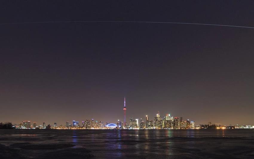
The ISS shoots over Toronto in this time-lapse photo taken on February 13, 2013. (Credit: Andrew Yee)
Did you know that you can see the International Space Station (ISS) in the night sky as it passes over your area at a distance of approximately 400 km from Earth?
To the naked eye, the Space Station looks like a big white dot that moves quickly across the sky without changing direction, unlike aircraft, for example. It is usually the brightest object in the night sky after the Moon—bright enough to be seen in urban areas even through all the light pollution.
Here are some sites and Web applications that will help you track the Station or catch a glimpse of it.
-
Find out when the Station will be passing over your area in the next two weeks.
-
Observe the Space Station's movements live on a world map.
-
Live video from the orbiting laboratory.