
Autonomous robots for planetary exploration
Credit: Canadian Space Agency
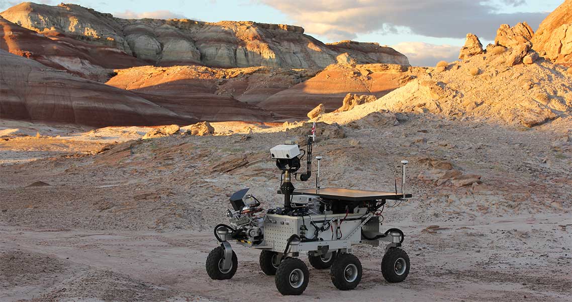
During the Mars sample return simulation in the Utah desert, the Canadian Space Agency (CSA) tested the autonomous navigation software developed by MDA, a Canadian company. From Canada, thousands of kilometres from the field site, the Mars Exploration Science Rover (MESR) operations team sent commands to the robot to test the software's capabilities. With autonomous navigation, MESR was able to establish its own routes and reach its destination by taking stock of its environment and any obstacles around it.
The MESR moving autonomously during the 2016 Mars Sample Return Simulation, in the Utah Desert. (Credit: CSA)
How does MESR's autonomous navigation system work?
A computer that uses autonomous navigation software can be thought of as the brains of the operation. The robot or rover is equipped with a number of tools, including a laser camera to characterize the immediate environment, encoders to determine wheel rotation, and accelerometers to measure movement. Based on the data collected, the rover analyzes the surrounding terrain and creates its own map of the immediate environment. Once it has established a safe path that is free of obstacles, it takes that path. As it moves along, the robot analyzes its position continuously in order to stay on track. Every few metres, it repeats the process until it reaches its destination, where it awaits new commands from the operator.
A solution for the mining sector
Although the software prototype was originally intended for the space sector, MDA has been able to push the technology further. Thanks to the CSA's investments, the company has amassed considerable knowledge, which it has used to develop a commercial product now employed in the mining sector.
An Australian company is currently using the software on its vehicles in underground mines. A vehicle operator can command a vehicle to go to a specific destination in the mine, and the vehicle will get there safely and autonomously, increasing the efficiency of mine operations.
MDA has also gone to South Africa to demonstrate another technology that is designed for space but has potential applications in the mining sector on Earth. Its purpose is to assist with underground positioning by means of a laser camera, which would allow vehicles using the system to navigate a mine with great precision. The technology could play a similar role with GPS signals, which are unavailable underground.
History of autonomous navigation in the Canadian space sector
The CSA first started working in autonomous navigation in . The initial objective was to advance research in the field. Thanks to the funding provided under Canada's Economic Action Plan, a number of contracts were awarded to Canadian companies to develop autonomous navigation technology for rovers. MDA, Neptec and MPB Communications have risen to the challenge with their excellent accomplishments.
Did you know?
CSA astronaut Robert Thirsk was the first person to remotely operate a rover from space during his stay aboard the International Space Station in .